Click to visit the main New York Public Library Homepage
The New York Public Library
Digital Collections
About Digital Collections
Browse
Search only public domain materials
Items
Collections
Divisions
Home
Search
Browse
About
Search only public domain materials
Items
Collections
Divisions
Digital Collections
Using Images
Using Data
Search
Filtered search
Show filters
Hide filters
Show Only Public Domain
topic
x
Real property
Fire insurance
5092
Cities & towns
5006
Business enterprises
251
Description and travel
156
More
Less
name
Sanborn Map Company
5102
G.W. Bromley & Co
1788
Ullitz, Hugo
606
E.B. Hyde & Co
545
E. Belcher Hyde Map Company
488
More
Less
collection
Atlases of New York City
7756
Atlases of the United States
1365
Maps of North America
170
Maps of New York City and State
120
Photographic views of New York City, 1870's-1970's, from the collections of the New York Public Library
14
More
Less
place
New York (State)
9033
New York
2735
Manhattan (New York, N.Y.)
1430
Brooklyn (New York, N.Y.)
783
Maps
410
More
Less
genre
Maps
9183
Atlases
1362
Cadastral maps
279
Indexes
118
Title pages
55
More
Less
publisher
Sanborn Map Company
5008
G.W. Bromley & Co
1608
E. Belcher Hyde
425
E. Robinson Co
246
F. W. Beers & Co
148
More
Less
division
Map Division
9384
Milstein Division
43
Schomburg Jean Blackwell Hutson Research and Reference Division
10
Manuscripts and Archives Division
6
type
cartographic
9236
text
258
still image
36
Date Range
to
9,443 results found
Filtering on:
x
Date
: 1873 - 1932
x
Topic
: Real property
Sort by:
Title
Date created
Date digitized
Sequence
Lloyd's topographical map of …
m
Map of the Cedar Knolls, at B…
m
146 Cherry Street in the "Lun…
m
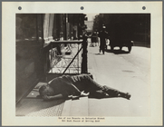
Corner of Cherry Street and M…
m
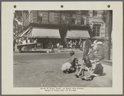
Youth Learning to Gamble on C…
m
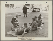
Cherry Street Near Market Sli…
m
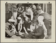
One of our Tenants on Catheri…
m
Map of property belonging to …
Map of lots belonging to the …
Map of Brooklyn Manor
Map of Flatbush Meadows : sit…
Tracts and farms with street …
Rosedale Square, Rosedale : 4…
Map of Jamaica in the 4th war…
Map of property New York Dock…
Map of Kissena Park, third wa…
Block sketch 1679, New York C…
East River Heights, first war…
Map of Bellaire Estates : own…
Hollis Terrace addition no. 1…
Map of 272 lots in the 30th w…
Map of Jamaica Fells : fourth…
m
Map of the borough of Queens,…
Borough Park Company
m
Sea Gate, New York Harbor
Map of Elmhurst Square : situ…
Plan of the great meadows of …
m
Driving road chart of the cou…
Block no. 86 : confidential r…
Livingston Heights : Livingto…
Map of portion of greater New…
m
Bronx: Broadway - 238th Stree…
Map showing locations of Dela…
Map of the city of San Jose
Harrison's map of Jersey City…
m
Map of property at Fairmount…
A map of the town of New-ark …
Plan of real estate at Harris…
Plan of land on West Chester …
Map of the city of Detroit, 1…
m
Map of Bates County, Missouri
m
Map of Johnson County, Missou…
m
Map of Pettis County, Missour…
m
Wright's map of Kansas City, …
m
Map of Stearns County, Minnes…
m
Map of Hennepin County, Minne…
m
Map of Meeker County, Minneso…
m
Map of McLeod County, Minneso…
Map of the Cherokee strip, In…
m
Map of Christian County, Ky. …
1
2
3
4
5
6
7
8
9
10
…
37
38
Previous
Next
1
2
3
4
5
6
7
8
9
10
…
37
38
Previous
Next