Click to visit the main New York Public Library Homepage
The New York Public Library
Digital Collections
About Digital Collections
Browse
Search only public domain materials
Items
Collections
Divisions
Home
Search
Browse
About
Search only public domain materials
Items
Collections
Divisions
Digital Collections
Using Images
Using Data
Search
Filtered search
Show filters
Hide filters
Show Only Public Domain
topic
Real property
4247
Fire insurance
3109
Cities & towns
3086
Administrative and political divisions
283
Railroads
250
More
Less
name
Sanborn Map Company
3086
E. Robinson Co
244
Everts, Ensign & Everts
231
Beers, F. W. (Frederick W.)
220
Pidgeon, R. H. (Roger H.)
204
More
Less
collection
Atlases of New York City
3524
Atlases of the United States
1301
Maps of North America
758
Maps of New York City and State
314
Atlases, gazetteers, guidebooks and other books
29
More
Less
place
New York (State)
4421
New York
387
Brooklyn (New York, N.Y.)
252
New York (N.Y.)
204
Erie County
148
More
Less
genre
Maps
5821
Atlases
1297
Cadastral maps
131
Plans
85
Topographic maps
54
More
Less
publisher
Sanborn Map Company
3086
E. Robinson Co
197
F. W. Beers & Co
148
G.M. Hopkins & Co
108
Everts, Ensign & Everts
99
More
Less
division
x
Map Division
type
cartographic
5866
text
99
still image
40
Date Range
to
5,953 results found
Filtering on:
x
Date
: 1874 - 1889
x
Division
: Map Division
Sort by:
Title
Date created
Date digitized
Sequence
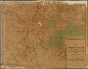
Lloyd's topographical map of …
m
Johnson's Physical Map
England & Wales
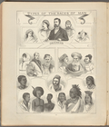
Types of the races of man
Map of the country thirty thr…
Sketch map of the City of New…
Sketch map of the city of New…
Map of the Hackensack & New Y…
Map of New York, Brooklyn, an…
m
The surroundings of New York …
Map showing the present dista…
Map of the country thirty thr…
New map of the great metropol…
m
Taunton new guide map and dir…
Map of New York City, south o…
m
New map of Kings and Queens c…
New map of Brooklyn and vicin…
m
Robinson's map of New York Ci…
m
Driving road chart of the cou…
m
Map of the Passaic and Croton…
m
Watson's new map of New York …
m
Watson's new map of New York …
Ethnological Chart of the Wor…
Official map of Michigan : ra…
Zeichenerklärung
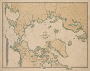
Map of the North Polar Region
Map of the city of San Jose
Map of the lakes & drives aro…
Map of the Gogebic Iron Range…
Plan of the city of Philadelp…
Map of the Rhode Island state…
Map of Conanicut Island, oppo…
Gardiner G. Hubbard's subdivi…
Water shed of the Passaic Riv…
Colton's excursion map of Nor…
Progress map of the state of …
Back Bay and Parker Hill park…
Plan of burnt district (by fi…
Plan of real estate at Harris…
Plan showing the redoubt, bre…
Map of Boston for 1878: Publi…
Map of Boston and the country…
Map of New England, with adja…
Map of New England with adjac…
Map of New England and the pr…
Map showing the line of the N…
Carte pittoresque des environ…
m
New map of the city of Philad…
m
New map of the city of Philad…
New and improved map of the c…
1
2
3
4
5
6
7
8
9
10
…
23
24
Previous
Next
1
2
3
4
5
6
7
8
9
10
…
23
24
Previous
Next