Click to visit the main New York Public Library Homepage
The New York Public Library
Digital Collections
About Digital Collections
Browse
Search only public domain materials
Items
Collections
Divisions
Home
Search
Browse
About
Search only public domain materials
Items
Collections
Divisions
Digital Collections
Using Images
Using Data
Search
Filtered search
Show filters
Hide filters
Show Only Public Domain
topic
Indian reservations
11
Lumber industry
8
Railroads
6
Loggers
5
Real property
5
More
Less
name
Keystone View Company
8
Singley, B. L. (Benjamin Lloyd)
8
Julius Bien & Co
7
Northern Transcontinental Survey
6
Pumpelly, Raphael, 1837-1923
6
More
Less
collection
Maps of North America
23
Robert N. Dennis collection of stereoscopic views
19
Wallach Division Picture Collection
3
Detroit Publishing Company postcards
2
America revisited: from the bay of New York to the Gulf of Mexico, and from Lake Michigan to the Pacific
1
More
Less
place
x
Washington (State)
Oregon
7
United States
5
Idaho
4
Seattle
4
More
Less
genre
Maps
23
Photographs
20
Stereographs
19
Topographic maps
7
Cadastral maps
4
More
Less
publisher
Northern Transcontinental Survey?
6
Detroit Publishing Company
2
Matthews, Northrup & Co
2
Poole Bros.?
2
The Office
2
More
Less
division
Map Division
23
Wallach Division: Photography Collection
21
Wallach Division: Picture Collection
3
Manuscripts and Archives Division
1
Schomburg Jean Blackwell Hutson Research and Reference Division
1
More
Less
type
still image
28
cartographic
23
text
1
Date Range
to
50 results found
Filtering on:
x
Date
: 1874 - 1899
x
Place
: Washington (State)
Sort by:
Title
Date created
Date digitized
Sequence
Tunnel site in Glen Canyon, B…
Forest map of the Yakima Regi…
Preliminary agricultural map …
m
Preliminary agricultural map …
Map of Yakima Region, Washing…
Map of Yakima Region, Washing…
Traver's map of Tacoma and en…
Map of the city of Tacoma : P…
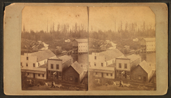
City of Spokane Falls, Washin…
Spokane Falls : showing in re…
Whitney's map of Seattle and …
Map of Colville Region, Washi…
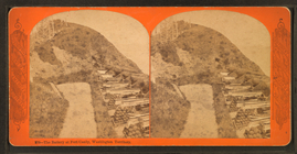
Washington Territory
Map of Washington Territory
Map of Washington Territory :…
Washington Territory
Washington Territory
Map of part of Washington and…
Map of the Oregon Railroad an…
Map of the Oregon Railroad an…
County and township map of Or…
Colton's map of Oregon & Wash…
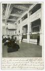
The Rotunda at Washington.
Map of the Department of the …
Thirteenth l. h. district
Interior, G. N. & N. P. Stati…
Oldest Church Tower in Americ…
m
The battery at Fort Canby, Wa…
m
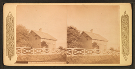
Our first home, Washington te…
m
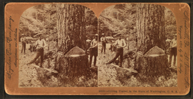
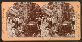
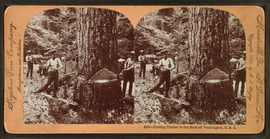
Cutting timber in the state o…
m
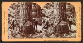
Cutting timber in the state o…
m
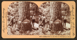
Cutting timber in the state o…
m
Cutting timber in the state o…
m
Cutting timber in the state o…
m
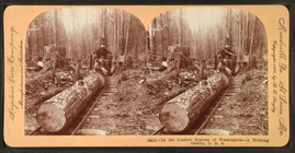
In the lumber regions of Wash…
m
Snoqualmie Falls, Columbia Ri…
m
The Minnesota dog team on tra…
m
Unloading logs, Puget Sound, …
m
Post office at Riverside, Was…
m
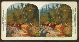
Logging in the state of Washi…
m
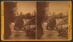
Falls of Tumwater (Tumbling w…
m
The creek on the left is What…
m
General stereoscopic views of…
m
Rose bush arbor, Washington.
m
Seattle and harbor, Puget Sou…
m
Lillewaup, Great Falling Wate…
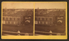
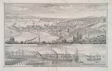
Seattle, Washington Territory…
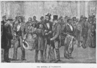
The anti-Chinese riot at Seat…
Puget Sound chiefs : The Duke…
Canoe burial
End of results
|
Top