Click to visit the main New York Public Library Homepage
The New York Public Library
Digital Collections
About Digital Collections
Browse
Search only public domain materials
Items
Collections
Divisions
Home
Search
Browse
About
Search only public domain materials
Items
Collections
Divisions
Digital Collections
Using Images
Using Data
Search
Filtered search
Show filters
Hide filters
Show Only Public Domain
topic
Altitudes
3
Geology
2
Administrative and political divisions
1
Coal
1
Coal mines and mining
1
More
Less
name
Austro-Hungarian Monarchy. Militärgeographisches Institut
5
Bien, Julius, 1826-1909
4
Gannett, Henry, 1846-1914
3
Guyot, A. (Arnold), 1807-1884
3
Hart, Lane S
3
More
Less
collection
Maps of North America
10
Spezialkarte der Osterreichisch-Ungarischen Monarchie
5
Maps of New York City and State
3
place
Catskill Mountains (N.Y.)
3
New York (State)
3
Pennsylvania
3
United States
3
Wyoming
2
More
Less
genre
x
Topographic maps
Maps
18
Geological maps
2
Charts
1
Diagrams
1
publisher
K.u.K. Militargeographisches Institut
5
C. Scribner's Sons
3
Board of Commissioners for the Second Geological Survey
1
Department of the Interior, U.S. Geological and Geographical Survey of the Territories
1
Geological Survey of Pennsylvania
1
More
Less
division
Map Division
18
type
cartographic
18
Date Range
to
18 results found
Filtering on:
x
Date
: 1876 - 1880
x
Genre
: Topographic maps
Sort by:
Title
Date created
Date digitized
Sequence
Nell's new topographical & to…
Map of Utah territory: repres…
Montana and Wyoming Territori…
Yellowstone National Park
Topographical map of the coal…
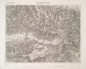
Geological map of the environ…
m
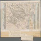
Map of the Catskill Mountains
Topographical map in thirty-f…
Map of the White Mountains of…
New Haven, Connecticut
Hypsometric map of the United…
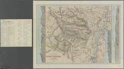
Map of the Catskill Mountains
m
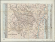
Map of the Catskill Mountains
Quellencebiet Der Gran
Kaschau (Ungarn). …
Kaschau (Ungarn). …
Braunau und Triftern.
Klausen. …
End of results
|
Top