Click to visit the main New York Public Library Homepage
The New York Public Library
Digital Collections
About Digital Collections
Browse
Search only public domain materials
Items
Collections
Divisions
Home
Search
Browse
About
Search only public domain materials
Items
Collections
Divisions
Digital Collections
Using Images
Using Data
Search
Filtered search
Show filters
Hide filters
Show Only Public Domain
topic
Real property
643
Administrative and political divisions
167
Railroads
156
Landowners
67
Pictorial works
39
More
Less
name
Everts, Ensign & Everts
231
G.M. Hopkins & Co
193
F.W. Beers & Co
148
G.W. Bromley & Co
79
O.W. Gray & Son
76
More
Less
collection
Atlases of the United States
735
Maps of North America
436
Atlases of New York City
179
Maps of New York City and State
158
Atlases, gazetteers, guidebooks and other books
26
More
Less
place
New York (State)
713
New York
211
Brooklyn (New York, N.Y.)
168
Erie County
148
Erie County (N.Y.)
148
More
Less
genre
x
Maps
Atlases
732
Cadastral maps
62
Topographic maps
36
Geological maps
23
More
Less
publisher
F. W. Beers & Co
148
G.M. Hopkins & Co
101
Everts, Ensign & Everts
99
G. W. Bromley & E. Robinson
78
Reading Publishing House
71
More
Less
division
Map Division
1542
Wallach Division: Photography Collection
9
Wallach Division: Picture Collection
8
Manuscripts and Archives Division
5
General Research Division
2
More
Less
type
cartographic
1566
still image
36
text
15
Date Range
to
1,575 results found
Filtering on:
x
Date
: 1876 - 1883
x
Genre
: Maps
Sort by:
Title
Date created
Date digitized
Sequence
Lloyd's topographical map of …
Map of Great Fire, 1776
North polar chart: track of t…
The countries round the North…
Map of the Hackensack & New Y…
Map of New York, Brooklyn, an…
m
The surroundings of New York …
Map showing the present dista…
Map of the country thirty thr…
New map of the great metropol…
m
Taunton new guide map and dir…
Map of New York City, south o…
New map of Brooklyn and vicin…
m
Watson's new map of New York …
Ethnological Chart of the Wor…
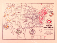
Standard Railway Time (outlin…
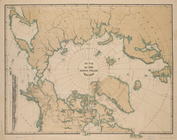
Map of the North Polar Region
Plan of the city of Philadelp…
Water shed of the Passaic Riv…
Progress map of the state of …
Back Bay and Parker Hill park…
Plan of burnt district (by fi…
Plan of real estate at Harris…
Plan showing the redoubt, bre…
Map of Boston for 1878: Publi…
Map of New England, with adja…
Map of New England with adjac…
Map of New England and the pr…
Map--S'emka Bolgarii mezhdu R…
S'emka Bolgarii mezhdu R. R. …
m
Reid, Harry Fielding
m
New map of the city of Philad…
New and improved map of the c…
State of Minnesota
Map of a part of the Village …
Plan of the grounds and build…
Our centennial--plan of the g…
Transportation lines tributar…
Map of the Indiana North and …
State of Indiana
City of Baltimore
This plan of the city of Phil…
m
Revised map of the state of T…
m
Map of Bates County, Missouri
m
Map of Johnson County, Missou…
m
Map of Pettis County, Missour…
m
Post route map of the state o…
m
Post route map of the state o…
Map of the White Mountains of…
m
Map showing Indian reservatio…
1
2
3
4
5
6
7
Previous
Next
1
2
3
4
5
6
7
Previous
Next