Click to visit the main New York Public Library Homepage
The New York Public Library
Digital Collections
About Digital Collections
Browse
Search only public domain materials
Items
Collections
Divisions
Home
Search
Browse
About
Search only public domain materials
Items
Collections
Divisions
Digital Collections
Using Images
Using Data
Search
Filtered search
Show filters
Hide filters
Show Only Public Domain
topic
Real property
229
Historic buildings
58
Buildings, structures, etc
31
Houses
31
Railroads
22
More
Less
name
G.M. Hopkins & Co
108
E. Robinson Co
77
Robinson, E. (Elisha)
77
Pidgeon, R. H. (Roger H.)
43
Austin, Daniel Berry
39
More
Less
collection
Atlases of New York City
222
Maps of New York City and State
49
Collection of photographs taken by Daniel B. Austin and his associate, Adam Dove, depicting buildings, street scenes and Brooklyn and Long Island views, particularly Flatbush, Gravesend and New Utrecht, and generally for the period 1885-1914
39
Photographic views of New York City, 1870's-1970's, from the collections of the New York Public Library
36
Collection of photographs of New York City
29
More
Less
place
x
Brooklyn (New York, N.Y.)
New York (State)
374
New York
356
New York (N.Y.)
127
Manhattan (New York, N.Y.)
13
More
Less
genre
Maps
260
Photographs
137
Prints
15
Clippings
11
Stereographs
9
More
Less
publisher
G.M. Hopkins & Co
108
E. Robinson Co
77
G. W. Bromley & E. Robinson
37
publisher not identified
7
B. W. Kilburn
4
More
Less
division
Map Division
271
Milstein Division
136
Wallach Division: Picture Collection
11
Wallach Division: Photography Collection
9
Wallach Division: Print Collection
8
More
Less
type
cartographic
261
still image
175
text
13
Date Range
to
445 results found
Filtering on:
x
Date
: 1876 - 1892
x
Place
: Brooklyn (New York, N.Y.)
Sort by:
Title
Date created
Date digitized
Sequence
m
Brooklyn: Devoe Street - Lori…
Map of New York, Brooklyn, an…
New map of the great metropol…
m
New guide map of New York Cit…
m
Taunton new guide map and dir…
m
New map of Kings and Queens c…
New map of Brooklyn and vicin…
m
Watson's new map of New York …
m
Watson's new map of New York …
m
Brooklyn: Court Street - Fult…
m
Brooklyn: Court Street - Jora…
m
Brooklyn: Court Street - Myrt…
m
Brooklyn: Clarendon Road - 22…
m
Brooklyn: Bedford Avenue - Di…
m
Brooklyn: Bath Avenue - Bay 1…
m
Brooklyn: Atlantic Avenue - W…
m
Brooklyn: Clark Street - Fult…
m
Chapel Street in New Haven, C…
The street-car strike in Broo…
m
Brooklyn: 6th Avenue - Sterli…
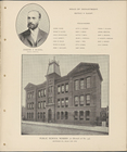
Joseph S. Burns, Branch Princ…
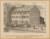
Kirk's Printing Office, birth…
General views, Nostrand Ave.
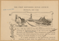
The First Reformed Dutch Chur…
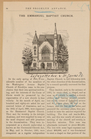
The Emmanuel Baptist Church
m
New map of Kings and Queens c…
Plan of the Battle of Long Is…
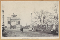
Main Entrance, Prospect Park
Three Mile House (1854)
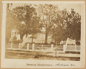
Boerum Homestead
Benson Homestead, Bensonhurst
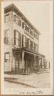
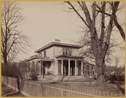
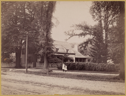
Victorian house
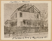
Martense House
Dutch style farm house with t…
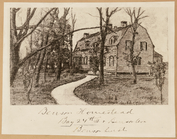
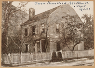
Owen Homestead
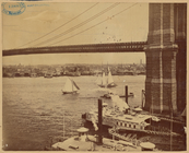
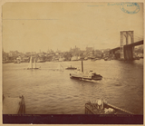
View of Manhattan from Brookl…
View of Manhattan from Brookl…
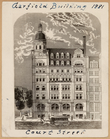
Garfield Building (1881)
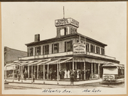
Howard House Hotel, East New …
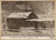
Flatbush Ave. & Livington St.
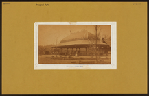
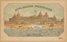
Hotel Brighton, Brighton Beach
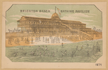
Brighton Beach, bathing pavil…
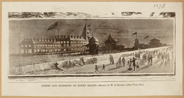
Scenes and incidents of Coney…
m
Brooklyn: Covered Walk - Stil…
m
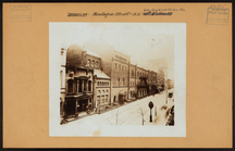
Brooklyn: Montague Street - C…
m
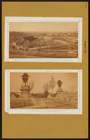
Brooklyn: Prospect Park.
m
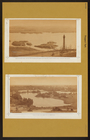
Brooklyn: Prospect Park.
m
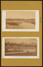
Brooklyn: Prospect Park.
m
Brooklyn: Prospect Park.
m
Brooklyn: Prospect Park - Sur…
1
2
Previous
Next
1
2
Previous
Next