Click to visit the main New York Public Library Homepage
The New York Public Library
Digital Collections
About Digital Collections
Browse
Search only public domain materials
Items
Collections
Divisions
Home
Search
Browse
About
Search only public domain materials
Items
Collections
Divisions
Digital Collections
Using Images
Using Data
Search
Filtered search
Show filters
Hide filters
Show Only Public Domain
topic
x
Administrative and political divisions
Railroads
132
Real property
42
Indian reservations
34
Landowners
32
More
Less
name
United States. General Land Office
49
Rand McNally and Company
38
Roeser, C. (Charles)
26
Bien, Julius, 1826-1909
24
G.W. & C.B. Colton & Co
22
More
Less
collection
Maps of North America
296
Maps of New York City and State
105
place
New York (State)
98
Massachusetts
37
New York (N.Y.)
36
Manhattan (New York, N.Y.)
34
Boston (Mass.)
25
More
Less
genre
Maps
401
Cadastral maps
34
Road maps
15
Topographic maps
6
Geological maps
3
More
Less
publisher
General Land Office
24
Department of the Interior, General Land Office
20
publisher not identified
17
G.W. & C.B. Colton & Co
15
Rand, McNally & Co
15
More
Less
division
Map Division
401
type
cartographic
401
text
8
still image
6
Date Range
to
401 results found
Filtering on:
x
Date
: 1877 - 1899
x
Topic
: Administrative and political divisions
Sort by:
Title
Date created
Date digitized
Sequence
The strangers mercantile guid…
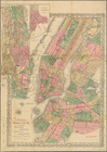
Map of New York, Brooklyn, an…
New map of the great metropol…
Map of the enlarged city of B…
Map of the 23rd and 24th ward…
m
Rand, McNally & Co.'s Minneso…
Rand, McNally & Co.'s New Jer…
Map of Boston for 1878: Publi…
Map of New England, with adja…
Map of New England with adjac…
m
New map of the city of Philad…
m
New map of the city of Philad…
State of Minnesota
Map of Minnesota : compiled f…
Map showing the boulevards an…
State of Indiana
Map of the city of Detroit, 1…
m
Map of Stearns County, Minnes…
m
Post route map of the states …
Map of the City of Baltimore …
Houston Post map of the great…
Territory of Dakota
State of Wisconsin
Map of the state of Wisconsin
Map of the state of Wisconsin
Rand McNally & Co.'s North Da…
Rand McNally & Co.'s new sect…
m
Post route map of the states …
Kentucky
m
New map of Kings and Queens c…
State of Minnesota : 1887 : c…
New map of the state of Minne…
New map of the city of Philad…
New map of the city of Philad…
New map of the city of Philad…
m
Map of the state of Minnesota…
m
Post route map of the state o…
Post route map of the state o…
Map of Rochester, Olmsted Co.…
State of Michigan
Map of Michigan and Wisconsin…
Map of the city of Detroit : …
m
Abbott's map of the city of M…
m
Post route map of the state o…
Rand, McNally & Co's standard…
Official map of the state of …
State of Illinois
The Civic Federation map of C…
m
Map of Monroe County, Wiscons…
Indian Territory
1
2
Previous
Next
1
2
Previous
Next