Click to visit the main New York Public Library Homepage
The New York Public Library
Digital Collections
About Digital Collections
Browse
Search only public domain materials
Items
Collections
Divisions
Home
Search
Browse
About
Search only public domain materials
Items
Collections
Divisions
Digital Collections
Using Images
Using Data
Search
Filtered search
Show filters
Hide filters
Show Only Public Domain
topic
x
Local transit
Railroads
47
Piers
37
Administrative and political divisions
27
Buildings
15
More
Less
name
Rand McNally and Company
14
Matthews-Northrup Company
6
G.W. & C.B. Colton & Co
5
Hubacher, Max Henry, 1900-1989
5
Matthews-Northrup Works
5
More
Less
collection
Maps of New York City and State
90
Collection of photographs of New York City, New York State and more by Max Hubacher
5
place
New York (State)
89
New York (N.Y.)
79
Manhattan (New York, N.Y.)
75
New York
63
Brooklyn (New York, N.Y.)
27
More
Less
genre
Maps
90
Photographs
5
Tourist maps
3
Mass transit
2
Road maps
2
More
Less
publisher
Rand, McNally & Co
6
Matthews-Northrup Co
5
The Company
5
Brooklyn Daily Eagle
4
E. Belcher Hyde
4
More
Less
division
Map Division
90
Milstein Division
5
type
cartographic
90
still image
5
text
1
Date Range
to
95 results found
Filtering on:
x
Date
: 1877 - 1914
x
Topic
: Local transit
Sort by:
Title
Date created
Date digitized
Sequence
m
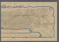
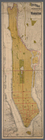
Map of Brooklyn
The Cord Meyer Development Co…
Railroads in Manhattan, Jerse…
The Brooklyn of the future : …
m
Map of the borough of Brookly…
Rapid transit map of Kings, Q…
m
Map of the borough of Queens,…
Rand, McNally & Co.'s new han…
m
Hammond's complete map of Bro…
Rand McNally & Co.'s new hand…
Center of New York, first cit…
New map of the great metropol…
m
New guide map of New York Cit…
m
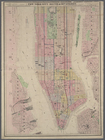
Manhattan borough and part of…
m
Rand-McNally standard map of …
Williams' map of boroughs of …
Map of boroughs of Manhattan …
m
Hammond's new guide map of Ma…
m
Taunton new guide map and dir…
Map of New York City : showin…
m
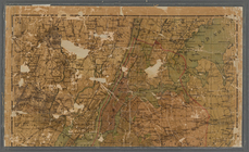
Topographical map of New York…
Map of portion of greater New…
m
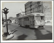
Brooklyn, N.Y. [streetcar]
m
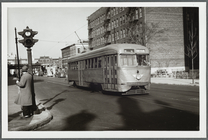
Brooklyn, N.Y. [streetcar]
m
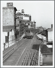
A modern streetcar in Brookly…
m
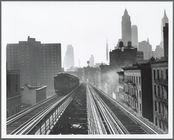
Third Avenue Elevated in New …
m
3rd Avenue Elevated
m
New map of the borough of Man…
m
Map of New York City : showin…
Map of New York City
Manhattan borough and part of…
m
New York City elevated railro…
Map of New York City: prepare…
m
Map of New York City: showing…
m
Map of New York City (Manhatt…
m
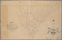
Map of New York City
m
Rand-McNally standard map of …
m
Colton's new map of the city …
m
Map of New York City
m
The Bridgman's new map of the…
m
Hammond's standard map of the…
New map of New York City: fro…
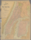
Map of the City of New York […
Map of New York City
Rand, McNally & Co.'s map of …
Pocket map of Broadway, New Y…
The largest and grandest comm…
m
Map of New York City : showin…
m
New map of New York City: fro…
m
Center of New York, first cit…