Click to visit the main New York Public Library Homepage
The New York Public Library
Digital Collections
About Digital Collections
Browse
Search only public domain materials
Items
Collections
Divisions
Home
Search
Browse
About
Search only public domain materials
Items
Collections
Divisions
Digital Collections
Using Images
Using Data
Search
Filtered search
Show filters
Hide filters
Show Only Public Domain
topic
Real property
378
Railroads
88
Administrative and political divisions
74
Landowners
35
Geology
16
More
Less
name
G.M. Hopkins & Co
164
F.W. Beers & Co
148
E. Robinson Co
47
Pidgeon, R. H. (Roger H.)
47
G.W. Bromley & Co
37
More
Less
collection
Atlases of the United States
281
Maps of North America
212
Atlases of New York City
137
Maps of New York City and State
87
Labor in Japan. Report by Consul-General Van Buren ..
7
More
Less
place
New York (State)
387
New York
155
Brooklyn (New York, N.Y.)
153
Erie County
148
Erie County (N.Y.)
148
More
Less
genre
x
Maps
Atlases
279
Cadastral maps
32
Topographic maps
21
Charts
11
More
Less
publisher
F. W. Beers & Co
148
G.M. Hopkins & Co
101
E. Robinson
47
The Company
42
G. W. Bromley & E. Robinson
36
More
Less
division
Map Division
722
Wallach Division: Photography Collection
7
Wallach Division: Picture Collection
5
Manuscripts and Archives Division
3
Wallach Division: Print Collection
2
More
Less
type
cartographic
736
still image
18
text
6
Date Range
to
741 results found
Filtering on:
x
Date
: 1880 - 1883
x
Genre
: Maps
Sort by:
Title
Date created
Date digitized
Sequence
Lloyd's topographical map of …
Map of the Hackensack & New Y…
New map of the great metropol…
m
Taunton new guide map and dir…
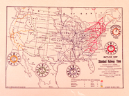
Standard Railway Time (outlin…
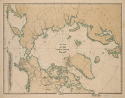
Map of the North Polar Region
Progress map of the state of …
Map of New England with adjac…
Map of New England and the pr…
m
Reid, Harry Fielding
m
New map of the city of Philad…
Transportation lines tributar…
Map of the Indiana North and …
City of Baltimore
This plan of the city of Phil…
m
Post route map of the state o…
m
Post route map of the state o…
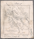
Map of the White Mountains of…
m
Map showing Indian reservatio…
m
Map of Stearns County, Minnes…
m
Map of Meeker County, Minneso…
m
Map of McLeod County, Minneso…
m
Post route map of the states …
Montana Territory
Houston Post map of the great…
m
Dakota Territory
Territory of Dakota
Map of the Cherokee strip, In…
Rand McNally & Co.'s new sect…
Map of a portion of Point Ke…
Map of Keweenaw Point and Por…
Rand, McNally & Co.'s Minneso…
City of Philadelphia
m
Map of Scott County, Minnesot…
m
Map of LeSueur County, Minnes…
m
Map of the state of Minnesota…
m
Post route map of the state o…
Post route map of the state o…
m
Abbott's map of the city of M…
m
Map showing land grant of Nor…
Cram's sectional map of Dakot…
Railroad map of Wisconsin : p…
Official map of the state of …
Position de l'armée Américain…
Indian Territory
Map of the South West
m
Preliminary post route map of…
m
Map of Delaware County, Iowa …
Map of the vicinity of Kansas…
County & township map of the …
1
2
3
Previous
Next
1
2
3
Previous
Next