Click to visit the main New York Public Library Homepage
The New York Public Library
Digital Collections
About Digital Collections
Browse
Search only public domain materials
Items
Collections
Divisions
Home
Search
Browse
About
Search only public domain materials
Items
Collections
Divisions
Digital Collections
Using Images
Using Data
Search
Filtered search
Show filters
Hide filters
Show Only Public Domain
topic
x
Landowners
Real property
87
Administrative and political divisions
18
History
8
Railroads
8
More
Less
name
Bourquin, F. (Frederick), 1808-
23
Warner & Foote
17
Bracher, Wm. (William)
12
Worley & Bracher
8
Hyde & Company
6
More
Less
collection
Maps of North America
73
Maps of New York City and State
46
Collection of Russian and Ukrainian posters, 1917-1921
3
History of the American Negro and his institutions : Georgia edition
2
Collection of property maps of parts of Westchester County, N.Y. : covering mostly Eastchester, Mount Vernon, and Yonkers
1
More
Less
place
New York (State)
46
Iowa
19
New York
17
Manhattan (New York, N.Y.)
7
California
6
More
Less
genre
Maps
120
Cadastral maps
82
Manuscript maps
6
Illustrations
5
Photographs
3
More
Less
publisher
publisher not identified
17
Published by Warner & Foote
16
Hyde & Company
5
J.B. Beers & Co
3
A.B. Caldwell Pub. Co
2
More
Less
division
Map Division
120
Schomburg Jean Blackwell Hutson Research and Reference Division
4
Rare Book Division
3
type
cartographic
120
still image
10
text
5
Date Range
to
127 results found
Filtering on:
x
Date
: 1881 - 1932
x
Topic
: Landowners
Sort by:
Title
Date created
Date digitized
Sequence
Lloyd's topographical map of …
m
Map of the Cedar Knolls, at B…
Tracts and farms with street …
Block sketch 1679, New York C…
m
Map of the borough of Queens,…
m
New map of Kings and Queens c…
m
Driving road chart of the cou…
Block no. 86 : confidential r…
Livingston Heights : Livingto…
m
Map of original grants and fa…
Map of the Rhode Island state…
A map of the town of New-ark …
A map of St. Augustine & vici…
m
New map of Kings and Queens c…
Map of a portion of Point Ke…
m
Map of Sibley County, Minneso…
m
Map of Ramsey and Washington …
A map of Philadelphia and par…
Map of a portion of the Salem…
Map of St. Joseph, Mo. and vi…
m
Map of Delaware County, Iowa …
m
Map of Polk County, Iowa : dr…
Map of Leavenworth, Kansas
m
Map of O'Brian County, Iowa :…
m
Map of Wright County, Iowa : …
m
Map of Adams County, Iowa : d…
Map of the city of Topeka, Sh…
Traver's map of Tacoma and en…
Whitney's map of Seattle and …
m
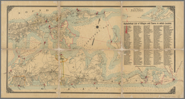
Map of Long Island: based upo…
m
Map of Long Island: based upo…
Louis Thompson and family.
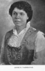
Annie E. Yarbrough.
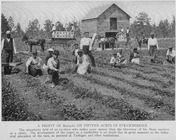
A profit of $2,723.61 on fift…
Birds-eye view of the Blue Gr…
m
Map of Multnomah County, Oreg…
Map of Baker City, Oregon
Map of revolutionary camp gro…
Map of the city of Stockton
m
Map of Stockton, Cal.
The City of Stockton and vici…
Map of the City of San Jose
m
The City of Stockton and vici…
Crocker's guide map of the ci…
Map of St. Joseph, Mo. and vi…
m
Map of Carroll County, Iowa :…
m
Map of Dallas County, Iowa : …
m
Map of Cherokee County, Iowa …
m
Map of Hamilton County, Iowa …
m
Map of Sioux County, Iowa : d…