Click to visit the main New York Public Library Homepage
The New York Public Library
Digital Collections
About Digital Collections
Browse
Search only public domain materials
Items
Collections
Divisions
Home
Search
Browse
About
Search only public domain materials
Items
Collections
Divisions
Digital Collections
Using Images
Using Data
Search
Filtered search
Show filters
Hide filters
Show Only Public Domain
topic
Administrative and political divisions
5
Coal
2
Coal leases
2
Coal mines and mining
2
Forests and forestry
2
More
Less
name
Julius Bien & Co
24
Bien, Julius, 1826-1909
15
Vermeule, C. C. (Cornelius Clarkson), 1858-1950
15
Geological Survey (U.S.)
13
Austro-Hungarian Monarchy. Militärgeographisches Institut
7
More
Less
collection
Maps of North America
28
Atlases of the United States
15
Spezialkarte der Osterreichisch-Ungarischen Monarchie
7
Maps of New York City and State
3
place
New York Metropolitan Area
16
New York (N.Y.)
15
Washington (State)
4
Massachusetts
3
New York (State)
3
More
Less
genre
x
Topographic maps
Maps
53
Atlases
15
Geological maps
2
Physical maps
2
More
Less
publisher
Julius Bien & Co
15
K.u.K. Militargeographisches Institut
7
U.S. Geological Survey
5
Northern Transcontinental Survey?
3
Appalachian Mountain Club
2
More
Less
division
Map Division
53
type
cartographic
53
text
2
Date Range
to
53 results found
Filtering on:
x
Date
: 1883 - 1893
x
Genre
: Topographic maps
Sort by:
Title
Date created
Date digitized
Sequence
m
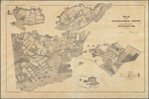
Topographical map of New York…
m
Nell's topographical & townsh…
Nell's topographical map of t…
Montana Fort Logan sheet
Montana Helena sheet
Forest map of the Yakima Regi…
Preliminary agricultural map …
m
Preliminary agricultural map …
Map of Washington Territory
A geological and topographica…
A geological and topographica…
A geological and topographica…
California, Nevada City speci…
m
Topographical and irrigation …
Illinois--Missouri, St. Louis…
Metropolitan district of Chic…
A geological and topographica…
United States contour map
Topographical map of the Dist…
Map of the city of Washington…
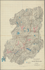
Topographical map of the stat…
m
United States
Map of the country about Bost…
Photolithograph of preliminar…
Topographical map of Monadnoc…
m
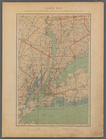
Map of Connecticut
m
Massachusetts
Map of Berkshire County
m
Map of Connecticut
Map showing topographical sur…
Aqueduct Commissioners topogr…
List of Plates and References
m
Double Page Plate No. 12: Wes…
Plate No. 1: Index Map
m
Double Page Plate No. 8: Long…
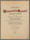
Atlas of the Metropolitan Dis…
m
Double Page Plate No. 3: Broo…
m
Double Page Plate No. 5: Rich…
m
Double Page Plate No. 10: Wes…
m
Double Page Plate No. 13: Wes…
m
Double Page Plate No. 6: Newa…
m
Double Page Plate No. 2: City…
m
Double Page Plate No. 11: Wes…
m
Double Page Plate No. 9: West…
m
Double Page Plate No. 4: The …
m
Double Page Plate No. 7: Newa…
Schemnitz und Karpen.
Brusztura.
Toblach und Cortina D'ampezzo…
I. St. Andrea.