Click to visit the main New York Public Library Homepage
The New York Public Library
Digital Collections
About Digital Collections
Browse
Search only public domain materials
Items
Collections
Divisions
Home
Search
Browse
About
Search only public domain materials
Items
Collections
Divisions
Digital Collections
Using Images
Using Data
Search
Filtered search
Show filters
Hide filters
Show Only Public Domain
topic
Administrative and political divisions
1
Charts, diagrams, etc
1
Floods
1
name
Gannett, Henry, 1846-1914
2
Geological Survey (U.S.)
2
E. Besley & Co
1
Editrice Artaria (Milan, Italy)
1
Friedenwald Co
1
More
Less
collection
Maps of North America
5
Maps of Africa
1
place
United States
2
Colorado
1
Conemaugh Valley
1
Conemaugh Valley (Pa.)
1
Egypt
1
More
Less
genre
x
Physical maps
Maps
5
Topographic maps
3
Aerial views
1
Pictorial maps
1
More
Less
publisher
U.S. Geological Survey
2
A.Y. Lee
1
Ditta editrice Artaria di Ferd. Sacchi e figli
1
E. Besley & Co., Publishers
1
Geological Survey of New Jersey
1
division
Map Division
6
type
cartographic
6
still image
1
Date Range
to
6 results found
Filtering on:
x
Date
: 1883 - 1896
x
Genre
: Physical maps
Sort by:
Title
Date created
Date digitized
Sequence
Nell's topographical map of t…
Bird's-eye view of the Conema…
United States contour map
United States relief map
Relief map of New Jersey: bas…
m
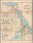
Carta dell' Egitto, Sudan, Ma…