Click to visit the main New York Public Library Homepage
The New York Public Library
Digital Collections
About Digital Collections
Browse
Search only public domain materials
Items
Collections
Divisions
Home
Search
Browse
About
Search only public domain materials
Items
Collections
Divisions
Digital Collections
Using Images
Using Data
Search
Filtered search
Show filters
Hide filters
Show Only Public Domain
topic
x
Landowners
Real property
41
Administrative and political divisions
8
History
7
Railroads
4
More
Less
name
Bourquin, F. (Frederick), 1808-
4
Balliet & Volk
3
Hyde & Company
3
Bates, Waldron
2
Britton & Rey
2
More
Less
collection
Maps of North America
26
Maps of New York City and State
22
Collection of Russian and Ukrainian posters, 1917-1921
3
History of the American Negro and his institutions : Georgia edition
2
Collection of property maps of parts of Westchester County, N.Y. : covering mostly Eastchester, Mount Vernon, and Yonkers
1
More
Less
place
New York (State)
23
New York
9
California
5
Manhattan (New York, N.Y.)
5
Stockton
4
More
Less
genre
Maps
49
Cadastral maps
36
Illustrations
4
Manuscript maps
3
Photographs
3
More
Less
publisher
publisher not identified
7
Hyde & Company
3
A.B. Caldwell Pub. Co
2
Dakin Pub. Co
2
Geo. W. Stadly and Co
2
More
Less
division
Map Division
49
Schomburg Jean Blackwell Hutson Research and Reference Division
4
Rare Book Division
3
type
cartographic
49
still image
9
text
5
Date Range
to
56 results found
Filtering on:
x
Date
: 1890 - 1917
x
Topic
: Landowners
Sort by:
Title
Date created
Date digitized
Sequence
m
Map of the Cedar Knolls, at B…
Tracts and farms with street …
Block sketch 1679, New York C…
m
Map of the borough of Queens,…
Livingston Heights : Livingto…
A map of the town of New-ark …
m
Map of Sibley County, Minneso…
A map of Philadelphia and par…
Map of a portion of the Salem…
Traver's map of Tacoma and en…
Whitney's map of Seattle and …
m
Map of Long Island: based upo…
m
Map of Long Island: based upo…
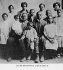
Louis Thompson and family.
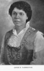
Annie E. Yarbrough.
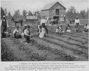
A profit of $2,723.61 on fift…
Map of Baker City, Oregon
Map of revolutionary camp gro…
Map of the city of Stockton
m
Map of Stockton, Cal.
The City of Stockton and vici…
m
The City of Stockton and vici…
Crocker's guide map of the ci…
Map of Omaha and Council Bluf…
Smyth County, Va.
m
Map of Elizabeth City Co., Va…
Allen's outline map of Ottumw…
Ottawa, Illinois, 1898 : situ…
Arbachoochee, Alabama : Dense…
Map of Orange County, Florida
Map of the head waters of the…
New York to New Rochelle: fro…
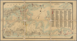
Map of Bar Harbor, Maine, 1896
Map of Swanzey, 1890: [New Ha…
Map of Bar Harbor, Maine, 1896
Map of Bar Harbor, Maine, 1895
m
Map of Mount Vernon and envir…
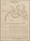
Hartford in 1640
Map of villa lots Arlington P…
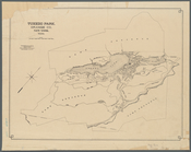
Tuxedo Park, Orange Co., New …
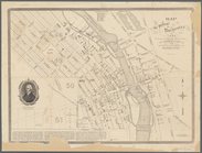
Map of the village of Rochest…
m
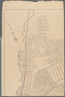
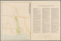
Upper Nyack
South Nyack
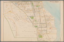
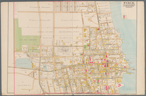
Nyack
Map of central portion of the…
Map of the province of New Yo…
Cattaraugus Reservation of th…
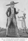
A typical Dutch Guiana plante…
Map of New York City between …
m
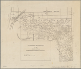
Property identification map o…