Click to visit the main New York Public Library Homepage
The New York Public Library
Digital Collections
About Digital Collections
Browse
Search only public domain materials
Items
Collections
Divisions
Home
Search
Browse
About
Search only public domain materials
Items
Collections
Divisions
Digital Collections
Using Images
Using Data
Search
Filtered search
Show filters
Hide filters
Show Only Public Domain
topic
x
City planning
Streets
5
Administrative and political divisions
3
Geology
3
Parks
3
More
Less
name
Risse, Louis A
3
Webster, Joseph O. B
3
Haffen, Louis F., 1854-1935
2
Welcke, Robert A
2
Brooklyn Daily Eagle (Firm)
1
More
Less
collection
Maps of New York City and State
12
Maps of North America
1
The Eno collection of New York City views
1
place
Manhattan (New York, N.Y.)
12
New York
12
New York (N.Y.)
12
New York (State)
12
Bronx (New York, N.Y.)
3
More
Less
genre
Maps
13
Manuscript maps
5
Aerial views
1
Prints
1
Topographic maps
1
publisher
publisher not identified
3
Department of Public Works
2
Robert A. Welcke, Photo-Lith
2
producer not identified
2
Board of Public Improvements, Topographical Bureau
1
More
Less
division
Map Division
13
Wallach Division: Print Collection
1
type
cartographic
14
still image
1
Date Range
to
14 results found
Filtering on:
x
Date
: 1893 - 1905
x
Topic
: City planning
Sort by:
Title
Date created
Date digitized
Sequence
The Brooklyn of the future : …
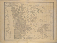
Map of the 23rd and 24th ward…
City of Lynn: [Massachusetts]
Map of the 23rd and 24th ward…
Map or plan showing the stree…
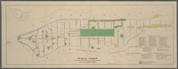
Public parks boroughs of Manh…
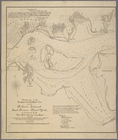
Proposed Harlem River Drive f…
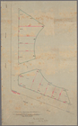
Modification in the pierhead…
m
Plan of the Harlem River Driv…
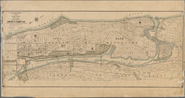
A map of the City of New York…
m
Map showing part of the city …
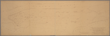
Diagram showing location of u…
m
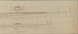
Profile of Riverside Drive fr…
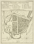
Ville de Manathe ou Nouvelle-…
End of results
|
Top