Click to visit the main New York Public Library Homepage
The New York Public Library
Digital Collections
About Digital Collections
Browse
Search only public domain materials
Items
Collections
Divisions
Home
Search
Browse
About
Search only public domain materials
Items
Collections
Divisions
Digital Collections
Using Images
Using Data
Search
Filtered search
Show filters
Hide filters
Show Only Public Domain
topic
x
Roads
Railroads
19
Mountains
13
Bridges
8
Administrative and political divisions
7
More
Less
name
National Highways Association
215
Rand McNally and Company
9
L. Prang & Co
8
Holmes, R. B
7
H.C. White Co
5
More
Less
collection
National Highways Association: Photographs
215
Detroit Publishing Company postcards
63
Maps of New York City and State
35
"The Pageant of America" Collection
25
Photographic views of New York City, 1870's-1970's, from the collections of the New York Public Library
13
More
Less
place
United States
221
New York (State)
56
New York
34
New York (N.Y.)
21
New York Metropolitan Area
16
More
Less
genre
Photographs
292
Postcards
71
Maps
49
Stereographs
12
Road maps
11
More
Less
publisher
Detroit Publishing Company
62
L. Prang & Co
8
The Company
5
Rand, McNally & Co
4
s.n
4
More
Less
division
General Research Division
220
Wallach Division: Photography Collection
117
Map Division
48
Milstein Division
13
Wallach Division: Picture Collection
11
More
Less
type
still image
379
cartographic
49
text
8
notated music
1
Date Range
to
429 results found
Filtering on:
x
Date
: 1897 - 1923
x
Topic
: Roads
Sort by:
Title
Date created
Date digitized
Sequence
m
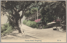
Garden Road, Hongkong
Map of New York City and vici…
Rand, McNally & Co.'s new aut…
m
Metropolitan district local a…
New York and vicinity roads a…
Road map of the New York dist…
Birdseye view of greater New …
m
Map showing 100 miles around …
Rand McNally official 1921 au…
m
Map showing 50 miles around N…
m
The five boroughs of the city…
American Automobile Associati…
Rand McNally standard map of …
m
Map of New York City : showin…
Map showing location of propo…
Plan of the great meadows of …
Rand McNally & Co.'s new hand…
Hammond's new guide map of Ma…
m
Hammond's new guide map of Ma…
m
Map of New York : showing Leh…
Map of New York City and vici…
m
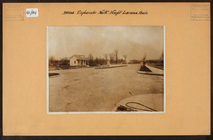
Bronx: Bronx and Pelham Par -…
m
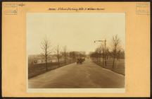
Bronx: Pelham Parkway North -…
m
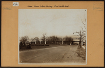
Bronx: Esplanade - Haight Ave…
Says the pieman to Simple Sim…
m
This is the cock that crowed …
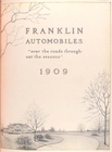
Franklin automobiles "over th…
Société des anciens établisse…
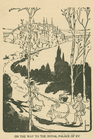
On the way to the royal palac…
Map of the city of Detroit, M…
m
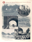
Bridges - Washington Bridge -…
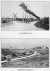
A Barbados road. ; Barbados l…
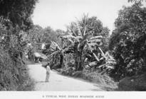
A typical West Indian roadsid…
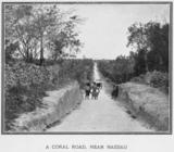
A coral road, near Nassau.
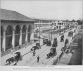
Government buildings, Kingsto…
Women on the way to market : …
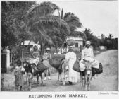
Returning from market; [Jamai…
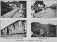
Country Huts and Highways, Po…
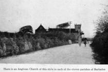
There is an Anglican Church o…
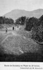
Route de Konakry au Niger au …
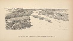
Une plaine du Lessouto: "Les …
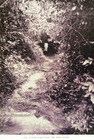
A bush road near the Mano riv…
m
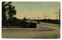
Entrance to Washington Bridge…
m
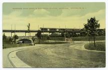
Bayridge Park Drive & rail-ro…
m
Baist's guide map of the famo…
Rhode Island
Map of the Dead River, Kenneb…
Road map of the Albany-Troy d…
Lines of proposed bridge to C…
Map of Cape Cod and vicinity
1
2
Previous
Next
1
2
Previous
Next