Click to visit the main New York Public Library Homepage
The New York Public Library
Digital Collections
About Digital Collections
Browse
Search only public domain materials
Items
Collections
Divisions
Home
Search
Browse
About
Search only public domain materials
Items
Collections
Divisions
Digital Collections
Using Images
Using Data
Search
Filtered search
Show filters
Hide filters
Show Only Public Domain
topic
Discovery and exploration
8
Streets
3
Parks
2
Agriculture
1
Cities and towns
1
More
Less
name
Austro-Hungarian Monarchy. Militärgeographisches Institut
682
Geological Survey (U.S.)
20
Walcott, Charles D. (Charles Doolittle), 1850-1927
11
United States. Congress (55th, 3rd session : 1898-1899)
9
Gannett, Henry, 1846-1914
4
More
Less
collection
Spezialkarte der Osterreichisch-Ungarischen Monarchie
682
Atlases of New York City
90
Maps of North America
25
Maps of New York City and State
7
place
Staten Island (New York, N.Y.)
90
Alaska
9
New York (State)
7
New York
5
Chugach Mountains (Alaska)
3
More
Less
genre
x
Topographic maps
Maps
804
Bathymetric maps
1
Military maps
1
Quadrangle maps
1
publisher
K.u.K. Militargeographisches Institut
682
U.S. Geological Survey
10
U.S. Congress
9
Board of Public Improvements, Topographical Bureau
2
Bureau of American Ethnology
1
More
Less
division
Map Division
804
type
cartographic
804
Date Range
to
804 results found
Filtering on:
x
Date
: 1898 - 1915
x
Genre
: Topographic maps
Sort by:
Title
Date created
Date digitized
Sequence
m
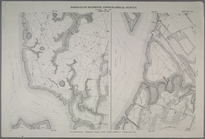
New York City and vicinity
Topographical map showing str…
m
New York und Umgegend
St. Johann im Pongau
Washington and vicinity, Mary…
m
United States
Topographical map of Fairmoun…
Colorado (Dolores County), Ri…
Colorado : Aspen special map
Montana, Helena special map
Detailed map of part of Canyo…
Alaska : Fortymile quadrangle
Hawaiian Islands
Explorations in Alaska, 1898 …
Alaska military expedition : …
Explorations in Alaska, 1898 …
Explorations in Alaska, 1898 …
Explorations in Alaska, 1898 …
Explorations in Alaska, 1898 …
Alaska route of military expe…
Alaska military expedition : …
United States contour map
New Jersey (Sussex County) Fr…
United States relief map
Map of the Metropolitan Distr…
Path map of the eastern part …
Map of the town of Roxbury
m
Map of Connecticut
Land classification map, New …
Lake Pleasant, - C.H. formerl…
Map or plan showing the stree…
m
General map of the city of Ne…
Richmond Borough: Index to Li…
Sheet Nos. 1 & 4. [Sheet No. …
Sheet No. 2. [Includes Richmo…
Sheet No. 3. [Includes Sailor…
Sheet Nos. 5 & 12. [Sheet No.…
Sheet No. 6. [Includes Hollan…
Sheet No. 7.[Includes Shooter…
Sheet No. 8. [Includes New Yo…
Sheet No. 9. [Includes Bennet…
Sheet No. 10. [Includes Sailo…
Sheet No. 11. [Includes New B…
Sheet No. 13. [Includes Old P…
Sheet No. 14. [Includes Marin…
Sheet No. 15. [Includes Port …
Sheet No. 16. [Includes West …
Sheet No. 17. [Includes Sailo…
Sheet No. 18. [Includes Gryme…
Sheet No. 19. [Includes Marks…
1
2
3
4
Previous
Next
1
2
3
4
Previous
Next