Click to visit the main New York Public Library Homepage
The New York Public Library
Digital Collections
About Digital Collections
Browse
Search only public domain materials
Items
Collections
Divisions
Home
Search
Browse
About
Search only public domain materials
Items
Collections
Divisions
Digital Collections
Using Images
Using Data
Search
Filtered search
Show filters
Hide filters
Show Only Public Domain
topic
Real property
287
Streets
279
Buildings
276
Building construction
271
Storefronts
193
More
Less
name
G.W. Bromley & Co
338
Rosenfeld, Morris, 1884-1968
260
Cathedral of St. John the Divine (New York, N.Y.)
212
Brown Brothers (New York, N.Y.)
179
Wurts Bros. (New York, N.Y.)
120
More
Less
collection
Photographic views of New York City, 1870's-1970's, from the collections of the New York Public Library
1608
Atlases of New York City
339
Morris Rosenfeld Photographs
260
Maps of New York City and State
71
Robert N. Dennis collection of stereoscopic views
69
More
Less
place
x
Manhattan (New York, N.Y.)
New York (N.Y.)
2073
New York (State)
1291
New York
1007
Broadway (New York, N.Y.)
197
More
Less
genre
Photographs
1949
Maps
404
Stereographs
69
Manuscript maps
10
Index maps
7
More
Less
publisher
G.W. Bromley & Co
290
G.W. Bromley
49
producer not identified
5
publisher unknown
5
August R. Ohman
4
More
Less
division
Milstein Division
1879
Map Division
411
Wallach Division: Photography Collection
70
Wallach Division: Print Collection
6
Wallach Division: Picture Collection
3
More
Less
type
still image
1960
cartographic
412
text
11
Date Range
to
2,371 results found
Filtering on:
x
Date
: 1900 - 1916
x
Place
: Manhattan (New York, N.Y.)
Sort by:
Title
Date created
Date digitized
Sequence
m
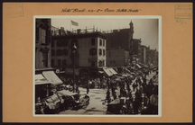
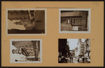
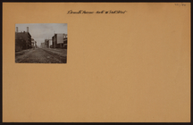
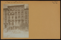
Manhattan: Hester Street - Es…
m
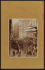
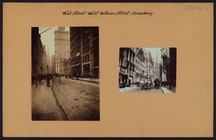
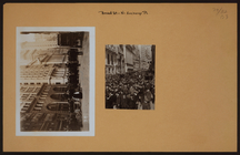
Manhattan: Wall Street
m
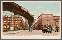
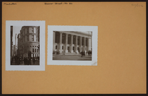
The Elevated at Eighth Avenue…
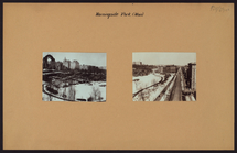
Carl Schurz Park
Park between 35th and 36th St…
m
Riverside Park
Colonial Park
City Hall Park
m
Tentative height districts, M…
m
Tentative use districts, Manh…
Freight terminal map of New Y…
Center of New York, first cit…
Hammond's new guide map of Ma…
Block line map of the heavy v…
m
Rand-McNally standard map of …
Williams' map of boroughs of …
Map of boroughs of Manhattan …
m
Hammond's new guide map of Ma…
m
Data for population from cens…
m
Borough of Manhattan, 300 foo…
m
Rand McNally commercial map o…
Map of Morningside Park
Upper Manhattan, comprising t…
The lower end of Manhattan Is…
Werpoes, a village of the Man…
Yorkville and East Harlem in …
H4. Map (Scheme B) illustrati…
m
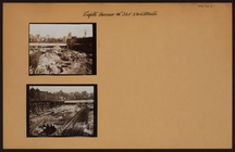
Manhattan: 23rd Street (West)…
m
Manhattan: James Street - Mad…
m
Manhattan: Amsterdam Avenue -…
m
Manhattan: Wall Street - Will…
m
Manhattan: Dey Street - West …
m
Manhattan: Broad Street - Exc…
m
Manhattan: 11th Avenue - 56th…
m
Manhattan: Broad Street - Exc…
m
Manhattan: Beaver Street - Wi…
m
Manhattan: 8th Avenue - 31st …
m
Manhattan: Broadway - 111th S…
m
Manhattan: 81st Street (West)…
m
Manhattan: 5th Avenue - 26th …
m
Manhattan: 119th Street (West…
m
Manhattan: 5th Avenue - 26th …
m
Manhattan: Madison Avenue - 2…
m
Manhattan: Central Park - Mis…
m
Manhattan: St. Nicholas Avenu…
m
Manhattan: Morningside Avenue…
m
Manhattan: Morningside Avenue…
m
Manhattan: Mail Street - Park…
m
Manhattan: Madison Avenue - 2…
m
Manhattan: Fulton Street - Fr…
1
2
3
4
5
6
7
8
9
10
Previous
Next
1
2
3
4
5
6
7
8
9
10
Previous
Next