Click to visit the main New York Public Library Homepage
The New York Public Library
Digital Collections
About Digital Collections
Browse
Search only public domain materials
Items
Collections
Divisions
Home
Search
Browse
About
Search only public domain materials
Items
Collections
Divisions
Digital Collections
Using Images
Using Data
Search
Filtered search
Show filters
Hide filters
Show Only Public Domain
topic
Real property
472
Description and travel
111
Fire insurance
63
Cities & towns
61
Local transit
13
More
Less
name
E. Belcher Hyde Map Company
196
E.B. Hyde & Co
196
Ullitz, Hugo
196
Century Map Company
111
A.H. Mueller (Publisher)
67
More
Less
collection
Atlases of New York City
615
Atlases of the United States
222
Maps of New York City and State
99
Spezialkarte der Osterreichisch-Ungarischen Monarchie
50
Liberia
8
More
Less
place
New York (State)
484
New York
308
Brooklyn (New York, N.Y.)
211
Maps
198
New York (N.Y.)
149
More
Less
genre
x
Maps
Atlases
222
Topographic maps
142
Indexes
45
Cadastral maps
31
More
Less
publisher
E. Belcher Hyde
232
Sanborn Map Company
191
Century Map Company
111
A.H. Mueller
67
G.W. Bromley & Co
63
More
Less
division
Map Division
959
Milstein Division
29
Schomburg Jean Blackwell Hutson Research and Reference Division
10
General Research Division
7
Manuscripts and Archives Division
7
More
Less
type
cartographic
967
text
58
still image
2
Date Range
to
1,013 results found
Filtering on:
x
Date
: 1903 - 1906
x
Genre
: Maps
Sort by:
Title
Date created
Date digitized
Sequence
m
Map of property belonging to …
Map of lots belonging to the …
Map of Brooklyn Manor
Rand, McNally & Co.'s new aut…
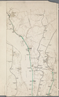
Map and profile showing sourc…
Brooklyn
Rosedale Square, Rosedale : 4…
m
Rand, McNally & Co.'s complet…
King's bird's-eye view of Bro…
Rand McNally standard map of …
Hollis Terrace addition no. 1…
Map of 272 lots in the 30th w…
The Brooklyn of the future : …
Map of Jamaica Fells : fourth…
m
Map of the borough of Brookly…
Rapid transit map of Kings, Q…
Brooklyn and vicinity
m
Map of the borough of Queens,…
m
King's birds-eye view of Broo…
Rand, McNally & Co.'s new han…
Topographical map showing str…
Rand McNally standard map of …
Map of Elmhurst Square : situ…
Center of New York, first cit…
The Merchants' Association's …
m
Map of New York : showing Leh…
m
Map of the borough of Brookly…
m
Map of the underground railwa…
m
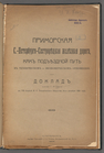
Primorskai︠a︡ S.-Peterburgo-S…
m
N.Y.C. & H.R.R.R. Electric Zo…
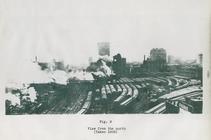
View from the north (figure 9)
Plan for preservation of Audu…
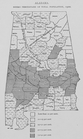
Alabama. Negro percentage of …
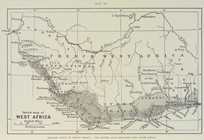
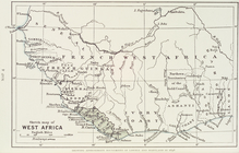
Sketch map of West Africa : s…
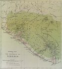
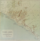
General map of the Republic o…
Sketch map of West Africa
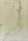
Map of the Sierra Leone - Lib…
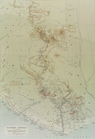
Western Liberia
Eastern Liberia
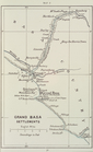
Grand Basa settlements
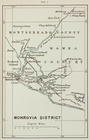
Monrovia district
m
McDonald, A.J
Map of the town of Roxbury
m
Cameron, Agnes Deans
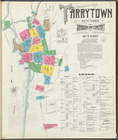
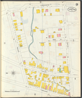
Insurance maps of Tarrytown, …
Insurance maps of Tarrytown, …
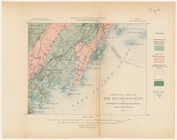
Geologic map of Rye, N.Y. and…
Plan of Cairo shewing naming …
m
1906 Library map of Manhattan…
m
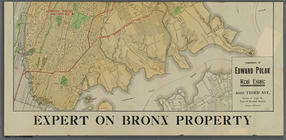
[Map of the Bronx] complement…
1
2
3
4
5
Previous
Next
1
2
3
4
5
Previous
Next