Click to visit the main New York Public Library Homepage
The New York Public Library
Digital Collections
About Digital Collections
Browse
Search only public domain materials
Items
Collections
Divisions
Home
Search
Browse
About
Search only public domain materials
Items
Collections
Divisions
Digital Collections
Using Images
Using Data
Search
Filtered search
Show filters
Hide filters
Show Only Public Domain
topic
Real property
269
Maps
87
Buildings
18
Streets
12
Buildings, structures, etc
11
More
Less
name
E. Belcher Hyde Map Company
265
E.B. Hyde & Co
265
Ullitz, Hugo
265
Bromley, George Washington
87
Bromley, Walter Scott
87
More
Less
collection
Atlases of New York City
352
Photographic views of New York City, 1870's-1970's, from the collections of the New York Public Library
65
Views of Brooklyn
49
Maps of New York City and State
31
Wallach Division Picture Collection
15
More
Less
place
x
Brooklyn (New York, N.Y.)
New York (State)
377
New York
373
Maps
269
New York (N.Y.)
93
More
Less
genre
Maps
355
Photographs
142
Indexes
14
Title pages
9
Views
9
More
Less
publisher
E. Belcher Hyde
268
G.W. Bromley & Co
87
L. H. Nelson Company
49
Museum of the American Indian, Heye Foundation
4
The Company
4
More
Less
division
Map Division
383
Milstein Division
137
Wallach Division: Picture Collection
14
Wallach Division: Photography Collection
3
Billy Rose Theatre Division
2
More
Less
type
cartographic
358
still image
163
text
33
notated music
1
Date Range
to
546 results found
Filtering on:
x
Date
: 1904 - 1913
x
Place
: Brooklyn (New York, N.Y.)
Sort by:
Title
Date created
Date digitized
Sequence
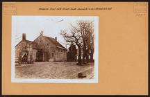
Map of the borough of Brookly…
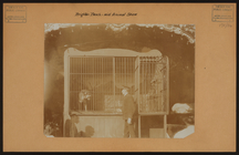
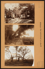
Floral steps, Prospect Park, …
m
Map of the borough of Brookly…
m
Map of property belonging to …
m
Map of Brooklyn
m
Petersen's map of Brooklyn
Williams' map of Borough of B…
Brooklyn
Map of property New York Dock…
King's bird's-eye view of Bro…
Map of the borough of Brookly…
Map of 272 lots in the 30th w…
m
Map of the borough of Brookly…
Brooklyn and vicinity
m
Borough of Brooklyn, 5th cong…
m
King's birds-eye view of Broo…
m
Eagle Almanac map of the boro…
Borough Park Company
Rand McNally & Co.'s new hand…
m
Brooklyn: Eastern Parkway - F…
m
Brooklyn: Downing Street - Qu…
m
Brooklyn: Crown Street - Nost…
m
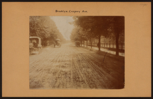
Brooklyn: Cropsey Avenue - Ba…
m
Brooklyn: Cropsey Avenue
m
Brooklyn: Court Street - Rems…
m
Brooklyn: Columbia Heights - …
m
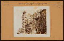
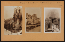
Brooklyn: Clinton Street - Mo…
m
Brooklyn: Coney Island Avenue…
m
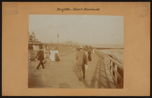
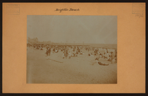
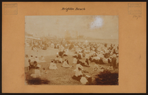
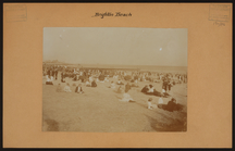
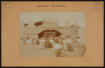
Brooklyn: Brighton Beach
m
Brooklyn: Coney Island Avenue…
m
Brooklyn: Brighton Beach
m
Brooklyn: Brighton Beach - wi…
m
Brooklyn: Oriental Boulevard …
m
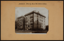
Brooklyn: Beverly Road - 21st…
m
Brooklyn: 55th Street (East) …
m
Brooklyn: 35th Street (East) …
m
Brooklyn: 35th Street (East) …
m
Brooklyn: 13th Avenue - 50th …
m
Brooklyn: 5th Street (South) …
m
Brooklyn: 4th Avenue - 46th S…
The lower end of Manhattan Is…
The southeastern part of the …
The southwestern part of the …
The Long Island City and Newt…
Bounded by Avenue K., Ralph A…
Bounded by E. 103rd Street, A…
Bounded by Avenue D., Ralph A…
Bounded by Rockaway Avenue, R…
Bounded by Ralph Avenue, E. 9…
Bounded by Avenue J., E. 56th…
1
2
3
Previous
Next
1
2
3
Previous
Next