Click to visit the main New York Public Library Homepage
The New York Public Library
Digital Collections
About Digital Collections
Browse
Search only public domain materials
Items
Collections
Divisions
Home
Search
Browse
About
Search only public domain materials
Items
Collections
Divisions
Digital Collections
Using Images
Using Data
Search
Filtered search
Show filters
Hide filters
Show Only Public Domain
topic
Real property
58
Parks
6
Local transit
5
Streets
4
Administrative and political divisions
3
More
Less
name
G.W. Bromley & Co
52
Sperr, Percy Loomis, 1890-1964
3
Matthews-Northrup Works
2
Trow Directory, Printing and Bookbinding Company
2
Welcke, Robert A
2
More
Less
collection
Atlases of New York City
76
Photographic views of New York City, 1870's-1970's, from the collections of the New York Public Library
16
Maps of New York City and State
13
Historical postcards of New York City
1
place
x
Queens (New York, N.Y.)
New York (N.Y.)
72
Long Island City (New York, N.Y.)
24
New York
19
New York (State)
19
More
Less
genre
Maps
89
Cadastral maps
53
Photographs
16
Manuscript maps
1
Postcards
1
More
Less
publisher
G. W. Bromley & Co
52
E. Belcher Hyde
24
Matthews-Northrup Works
2
August R. Ohman & Co. Map Publishers, Draughtsman & Engravers,
1
E. Belcher Hyde
1
More
Less
division
Map Division
89
Milstein Division
16
Wallach Division: Picture Collection
1
type
cartographic
85
still image
17
text
4
Date Range
to
106 results found
Filtering on:
x
Date
: 1906 - 1909
x
Place
: Queens (New York, N.Y.)
Sort by:
Title
Date created
Date digitized
Sequence
The Cord Meyer Development Co…
Map of Jamaica in the 4th war…
Map of Kissena Park, third wa…
Railroad suburbs between Holl…
East River Heights, first war…
Map of Bellaire Estates : own…
Hollis Terrace addition no. 1…
m
Map of the borough of Queens,…
Map of Bayside, third ward, b…
Topographical map showing str…
m
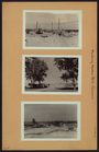
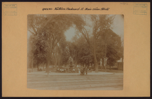
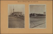
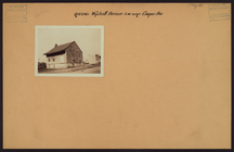
Queens: Rockaway Beach - [Pub…
m
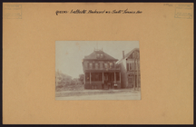
Evangelical Lutheran St. Paul…
m
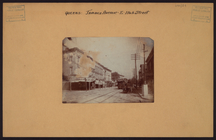
Queens: 41st Avenue - Union S…
m
Queens: 45th Avenue - Parsons…
m
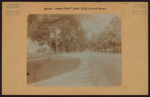
Queens: Bowne Street - 37th A…
m
Queens: Northern Boulevard - …
m
Queens: Jamaica Avenue - 116t…
m
Queens: Lefferts Boulevard - …
m
Queens: Northern Boulevard - …
m
Queens: Northern Boulevard - …
m
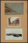
Queens: Rockaway Beach - [Ste…
m
Queens: Beach 101st Street - …
m
Queens: Rockaway Beach - Caro…
m
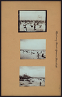
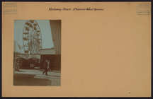
Queens: Rockaway Beach - Plea…
m
Queens: Rockaway Beach - Seid…
m
Queens: Sanford Avenue - Unio…
m
Queens: Wyckoff Avenue - Coop…
m
Map of the northern part of t…
Map of the northern part of t…
m
Library map 1908
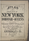
Atlas of the City of New York…
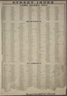
STREET INDEX: Long Island Cit…
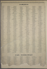
STREET INDEX: Jamaica -- Far …
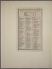
Index to Localities and Sub-D…
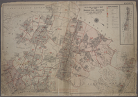
Outline and Index Map of the …
m
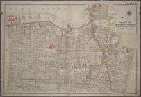
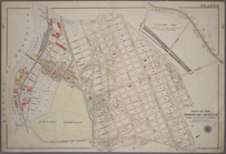
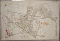
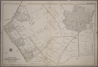
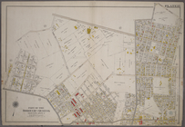
Plate 1: Bounded by (East Riv…
m
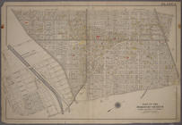
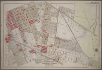
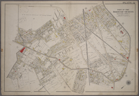
Plate 2: Bounded by (East Riv…
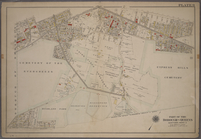
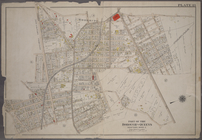
Plate 3:Bounded by (Dutch Kil…
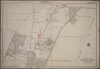
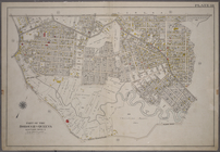
Plate 4: Bounded by Rapelje A…
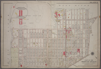
Plate 5: Bounded by (Con. Ed.…
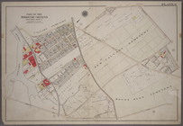
Plate 6: Bounded by Laurel Hi…
Plate 7: Bounded by Maspeth A…
Plate 8: Bounded by Stanhope …
Plate 9: Bounded by Covert St…
Plate 10: Bounded by Trotting…
Plate 11: Bounded by Juniper …
Plate 12: Bounded by Maurice …
Plate 13: Bounded by Astoria …
Plate 14: Bounded by Railroad…
Plate 15: Bounded by Meadow R…