Click to visit the main New York Public Library Homepage
The New York Public Library
Digital Collections
About Digital Collections
Browse
Search only public domain materials
Items
Collections
Divisions
Home
Search
Browse
About
Search only public domain materials
Items
Collections
Divisions
Digital Collections
Using Images
Using Data
Search
Filtered search
Show filters
Hide filters
Show Only Public Domain
topic
Parks
1566
Real property
1192
Apartment houses
1020
Building construction
774
Hotels
697
More
Less
name
Sperr, Percy Loomis, 1890-1964
4398
G.W. Bromley & Co
1238
E. & H.T. Anthony (Firm)
286
Rosenfeld, Morris, 1884-1968
262
Wurts Bros. (New York, N.Y.)
251
More
Less
collection
Photographic views of New York City, 1870's-1970's, from the collections of the New York Public Library
8357
Robert N. Dennis collection of stereoscopic views
1719
Atlases of New York City
1239
Morris Rosenfeld Photographs
260
Collection of photographs of New York City
133
More
Less
place
x
Manhattan (New York, N.Y.)
New York (N.Y.)
10677
New York (State)
6733
New York
6418
Central Park (New York, N.Y.)
1083
More
Less
genre
Photographs
10476
Stereographs
1719
Maps
1269
Indexes
27
Index maps
24
More
Less
publisher
G.W. Bromley & Co
1190
G.W. Bromley
49
E. & H.T. Anthony (Firm)
33
J. W. & J. S. Moulton
16
Kilburn Brothers
12
More
Less
division
Milstein Division
8754
Wallach Division: Photography Collection
1727
Map Division
1302
General Research Division
5
Wallach Division: Print Collection
4
More
Less
type
still image
10494
cartographic
1300
text
47
Date Range
to
11,799 results found
Filtering on:
x
Date
: 1906 - 1934
x
Place
: Manhattan (New York, N.Y.)
Sort by:
Title
Date created
Date digitized
Sequence
m
Manhattan: West Street - Spri…
m
Manhattan: West Street - Spri…
m
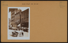
Manhattan: Hester Street - Es…
m
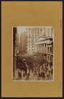
Manhattan: Wall Street
m
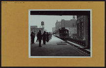
The Elevated at Eighth Avenue…
The Evening Mail's complete m…
Tracts and farms with street …
Carl Schurz Park
Park between 35th and 36th St…
Hagstrom's map of lower New Y…
m
Riverside Park
m
Map of Manhattan showing the …
Block sketch 1679, New York C…
m
Hammond's complete map of New…
Colonial Park
Rand McNally Map of Brooklyn
City Hall Park
m
Tentative height districts, M…
m
Tentative use districts, Manh…
Freight terminal map of New Y…
Hammond's new guide map of Ma…
Block line map of the heavy v…
m
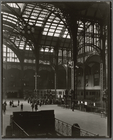
Penn. Station, Interior
m
Penn. Station, Interior
m
Hagstrom's map of upper New Y…
Williams' map of boroughs of …
Map of boroughs of Manhattan …
m
Hammond's new guide map of Ma…
m
Data for population from cens…
Hagstrom's New York house-num…
m
Financial district map of New…
m
Borough of Manhattan, 300 foo…
Map of the borough of Manhatt…
Block no. 86 : confidential r…
m
Street guide of Manhattan and…
Greater New York's Census dis…
m
Rand McNally commercial map o…
Hagstrom's map of ... New Yor…
Map of Morningside Park
m
Consolidated Edison powerhous…
m
Map of original grants and fa…
m
Penn. Station, Interior
m
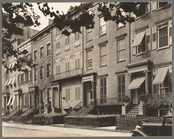
Washington Square North, #121…
m
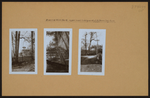
Manhattan: Inwood Hill Park.
m
Manhattan: Inwood Hill Park.
m
Manhattan: Inwood Hill Park.
m
Manhattan: Cherry Street - Ro…
Chief Points of Interest in L…
m
Manhattan: Broadway - 62nd St…
m
Manhattan: 68th Street (West)…
1
2
3
4
5
6
7
8
9
10
…
47
48
Previous
Next
1
2
3
4
5
6
7
8
9
10
…
47
48
Previous
Next