Click to visit the main New York Public Library Homepage
The New York Public Library
Digital Collections
About Digital Collections
Browse
Search only public domain materials
Items
Collections
Divisions
Home
Search
Browse
About
Search only public domain materials
Items
Collections
Divisions
Digital Collections
Using Images
Using Data
Search
Filtered search
Show filters
Hide filters
Show Only Public Domain
topic
Real property
1412
Cities & towns
848
Fire insurance
847
Maps
83
Railroads
41
More
Less
name
Sanborn Map Company
847
Austro-Hungarian Monarchy. Militärgeographisches Institut
588
G.W. Bromley & Co
489
Bromley, George Washington
363
Bromley, Walter Scott
363
More
Less
collection
Atlases of New York City
1822
Spezialkarte der Osterreichisch-Ungarischen Monarchie
588
Atlases of the United States
516
Maps of New York City and State
181
Materials relating to the development of railroads of the Russian Empire
10
More
Less
place
New York (State)
1546
New York (N.Y.)
454
New York
416
Maps
263
Brooklyn (New York, N.Y.)
252
More
Less
genre
x
Maps
Topographic maps
680
Atlases
507
Cadastral maps
52
Pamphlets
29
More
Less
publisher
Sanborn Map Company
974
K.u.K. Militargeographisches Institut
588
G.W. Bromley & Co
391
E. Belcher Hyde
252
E. Belcher-Hyde
112
More
Less
division
Map Division
3118
General Research Division
31
Manuscripts and Archives Division
11
Schomburg Jean Blackwell Hutson Research and Reference Division
7
Milstein Division
2
More
Less
type
cartographic
3160
text
48
still image
12
Date Range
to
3,170 results found
Filtering on:
x
Date
: 1907 - 1914
x
Genre
: Maps
Sort by:
Title
Date created
Date digitized
Sequence
m
Konspektʺ kʺ proektu Donet͡sk…
m
Poi͡asnitelʹnai͡a zapiska kʺ …
m
Proektʺ Karakovskoĭ zheli͡ezn…
m
Map of the Cedar Knolls, at B…
An old map of Heijokyo (Heijo…
An old map of Heiankyo (Heian…
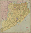
Map of the borough of Brookly…
m
Map of the borough of Brookly…
m
Map of Brooklyn
The Cord Meyer Development Co…
m
Petersen's map of Brooklyn
Williams' map of Borough of B…
m
Official map covering territo…
Map of Jamaica in the 4th war…
m
Flushing Bay, Long Island, N.…
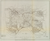
Railroads in Manhattan, Jerse…
Map of property New York Dock…
Carl Schurz Park
Park between 35th and 36th St…
m
Riverside Park
Map of Kissena Park, third wa…
Railroad suburbs between Holl…
East River Heights, first war…
Greater New York and Long Isl…
Map of the borough of Brookly…
Map of Bellaire Estates : own…
Map of New York City and the …
Panoramic view of New York Ci…
Map of Hudson & Manhattan Rai…
Colonial Park
City Hall Park
m
View of the city of New York …
Map of Brooklyn
m
Borough of Brooklyn, 5th cong…
Map of Hudson & Manhattan Rai…
Map of Bayside, third ward, b…
Greater New York City
m
Hammond's complete map of Bro…
m
Eagle Almanac map of the boro…
m
New York und Umgegend
Borough Park Company
Greater New York and its harb…
Map showing location of propo…
Map of borough of Richmond
Rand McNally & Co.'s new hand…
General plan of the city of H…
Diagrammatic plan for a moder…
General plan of the city of H…
Plan of the central section o…
Suggested type of layout for …
1
2
3
4
5
6
7
8
9
10
…
12
13
Previous
Next
1
2
3
4
5
6
7
8
9
10
…
12
13
Previous
Next