Click to visit the main New York Public Library Homepage
The New York Public Library
Digital Collections
About Digital Collections
Browse
Search only public domain materials
Items
Collections
Divisions
Home
Search
Browse
About
Search only public domain materials
Items
Collections
Divisions
Digital Collections
Using Images
Using Data
Search
Filtered search
Show filters
Hide filters
Show Only Public Domain
topic
Real property
786
Building construction
361
Streets
327
Apartment houses
316
Buildings
290
More
Less
name
G.W. Bromley & Co
835
Rosenfeld, Morris, 1884-1968
262
Bromley, George Washington
173
Bromley, Walter Scott
173
Wurts Bros. (New York, N.Y.)
139
More
Less
collection
Photographic views of New York City, 1870's-1970's, from the collections of the New York Public Library
2661
Atlases of New York City
836
Morris Rosenfeld Photographs
260
Robert N. Dennis collection of stereoscopic views
253
Collection of photographs of New York City
58
More
Less
place
x
Manhattan (New York, N.Y.)
New York (N.Y.)
3420
New York (State)
2621
New York
2351
Broadway (New York, N.Y.)
198
More
Less
genre
Photographs
3234
Maps
865
Stereographs
253
Index maps
19
Indexes
18
More
Less
publisher
G.W. Bromley & Co
787
G.W. Bromley
49
publisher unknown
5
Museum of the American Indian, Heye Foundation
4
C.S. Hammond
3
More
Less
division
Milstein Division
2981
Map Division
887
Wallach Division: Photography Collection
255
Wallach Division: Print Collection
4
Wallach Division: Picture Collection
2
More
Less
type
still image
3243
cartographic
886
text
30
Date Range
to
4,132 results found
Filtering on:
x
Date
: 1908 - 1925
x
Place
: Manhattan (New York, N.Y.)
Sort by:
Title
Date created
Date digitized
Sequence
The Evening Mail's complete m…
Tracts and farms with street …
Carl Schurz Park
Park between 35th and 36th St…
Hagstrom's map of lower New Y…
m
Riverside Park
m
Map of Manhattan showing the …
Block sketch 1679, New York C…
m
Hammond's complete map of New…
Colonial Park
Rand McNally Map of Brooklyn
City Hall Park
m
Tentative height districts, M…
m
Tentative use districts, Manh…
Hammond's new guide map of Ma…
Block line map of the heavy v…
m
Hagstrom's map of upper New Y…
Williams' map of boroughs of …
Map of boroughs of Manhattan …
m
Hammond's new guide map of Ma…
m
Data for population from cens…
Hagstrom's New York house-num…
m
Financial district map of New…
m
Borough of Manhattan, 300 foo…
Map of the borough of Manhatt…
Block no. 86 : confidential r…
m
Street guide of Manhattan and…
Greater New York's Census dis…
m
Rand McNally commercial map o…
Hagstrom's map of ... New Yor…
Map of Morningside Park
m
Manhattan: Inwood Hill Park.
m
Manhattan: Inwood Hill Park.
m
Manhattan: Inwood Hill Park.
m
Manhattan: Cherry Street - Ro…
Chief Points of Interest in L…
m
Manhattan: Broadway - 62nd St…
m
Manhattan: 68th Street (West)…
Upper Manhattan, comprising t…
The lower end of Manhattan Is…
Werpoes, a village of the Man…
Yorkville and East Harlem in …
m
R.L. Polk & Co.'s (Trow's) ge…
H4. Map (Scheme B) illustrati…
m
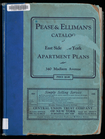
Pease & Elliman's catalog of …
m
Manhattan: 23rd Street (West)…
m
Manhattan: James Street - Mad…
m
Manhattan: Amsterdam Avenue -…
m
Manhattan: 125th Street - Ams…
m
Manhattan: Dey Street - West …
1
2
3
4
5
6
7
8
9
10
…
16
17
Previous
Next
1
2
3
4
5
6
7
8
9
10
…
16
17
Previous
Next