Click to visit the main New York Public Library Homepage
The New York Public Library
Digital Collections
About Digital Collections
Browse
Search only public domain materials
Items
Collections
Divisions
Home
Search
Browse
About
Search only public domain materials
Items
Collections
Divisions
Digital Collections
Using Images
Using Data
Search
Filtered search
Show filters
Hide filters
Show Only Public Domain
topic
Real property
236
Farmhouses
130
Apartment houses
90
Elevated railroads
87
Hotels
86
More
Less
name
E.B. Hyde & Co
231
E. Belcher Hyde Map Company
227
Ullitz, Hugo
227
Sperr, Percy Loomis, 1890-1964
94
Austin, Daniel Berry
43
More
Less
collection
Photographic views of New York City, 1870's-1970's, from the collections of the New York Public Library
1164
Atlases of New York City
231
Collection of photographs taken by Daniel B. Austin and his associate, Adam Dove, depicting buildings, street scenes and Brooklyn and Long Island views, particularly Flatbush, Gravesend and New Utrecht, and generally for the period 1885-1914
43
Maps of New York City and State
38
Scrapbooks of New York City views
6
More
Less
place
x
Brooklyn (New York, N.Y.)
New York (N.Y.)
1185
New York (State)
654
New York
647
Maps
106
More
Less
genre
Photographs
1225
Maps
248
Indexes
11
Title pages
6
Postcards
4
More
Less
publisher
E. Belcher Hyde
229
The Company
10
E. Belcher Hyde Map Co
4
Museum of the American Indian, Heye Foundation
4
Ohman Map Co
3
More
Less
division
Milstein Division
1221
Map Division
269
Wallach Division: Photography Collection
5
Wallach Division: Picture Collection
4
Berg Collection
1
More
Less
type
still image
1232
cartographic
255
text
24
Date Range
to
1,504 results found
Filtering on:
x
Date
: 1910 - 1929
x
Place
: Brooklyn (New York, N.Y.)
Sort by:
Title
Date created
Date digitized
Sequence
m
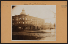
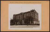
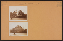
Brooklyn: Farragut Road - Ken…
Map of the borough of Brookly…
m
Hammond's complete map of Bro…
Map of the borough of Brookly…
Hammond's handy reference map…
m
Map of the borough of Brookly…
m
Petersen's map of Brooklyn
Map of Flatbush Meadows : sit…
Williams' map of Borough of B…
The Evening Mail's complete m…
Map of property New York Dock…
Brooklyn, from Rand McNally m…
Hammond's handy reference map…
m
Map of the borough of Brookly…
Brooklyn Liberty Loan Committ…
Bush Terminal, map showing bu…
Map of the borough of Brookly…
Rand McNally Map of Brooklyn
Map of Brooklyn
Street guide of Brooklyn : wi…
m
New quick reference street in…
m
Hammond's complete map of Bro…
Borough Park Company
m
Map of the borough of Brookly…
Plan of the great meadows of …
Rand McNally & Co.'s new hand…
m
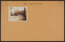
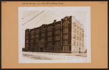
Brooklyn: Evergreen Avenue - …
m
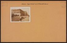
Brooklyn: Erasmus Street - Ro…
m
Brooklyn: Erasmus Street - Ro…
m
Brooklyn: Erasmus Street - Ro…
m
Brooklyn: Erasmus Street - Wo…
m
Brooklyn: Empire Boulevard - …
m
Brooklyn: Empire Boulevard - …
m
Brooklyn: Emmons Avenue - Coy…
m
Brooklyn: Emmons Avenue - 27t…
m
Brooklyn: Emmons Avenue - She…
m
Brooklyn: Emmons Avenue - 16t…
m
Brooklyn: Emmons Avenue - Sho…
m
Brooklyn: Elmore Place - Aven…
m
Brooklyn: Elmore Place - Aven…
m
Brooklyn: Elderts Lane - Jama…
m
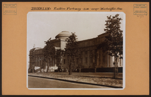
Brooklyn: Eastern Parkway - S…
m
Brooklyn: Eastern Parkway - F…
m
Brooklyn: Eastern Parkway - W…
m
Brooklyn: New York Avenue (Ea…
m
Brooklyn: New York Avenue (Ea…
m
Brooklyn: New York Avenue (Ea…
m
Brooklyn: New York Avenue (Ea…
m
Brooklyn: Dupont Street - Man…
m
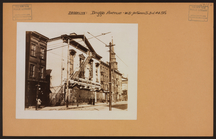
Brooklyn: Driggs Avenue - 3rd…
1
2
3
4
5
6
7
Previous
Next
1
2
3
4
5
6
7
Previous
Next