Click to visit the main New York Public Library Homepage
The New York Public Library
Digital Collections
About Digital Collections
Browse
Search only public domain materials
Items
Collections
Divisions
Home
Search
Browse
About
Search only public domain materials
Items
Collections
Divisions
Digital Collections
Using Images
Using Data
Search
Filtered search
Show filters
Hide filters
Show Only Public Domain
topic
Real property
337
Streets
220
Buildings
175
Educational facilities
147
Public schools
139
More
Less
name
G.W. Bromley & Co
332
Rosenfeld, Morris, 1884-1968
173
Bromley, George Washington
130
Bromley, Walter Scott
130
Wurts Bros. (New York, N.Y.)
64
More
Less
collection
Photographic views of New York City, 1870's-1970's, from the collections of the New York Public Library
1096
Atlases of New York City
333
Morris Rosenfeld Photographs
172
Maps of New York City and State
24
Collection of photographs of New York City
19
More
Less
place
x
Manhattan (New York, N.Y.)
New York (N.Y.)
1349
New York (State)
1164
New York
992
Broadway (New York, N.Y.)
108
More
Less
genre
Photographs
1290
Maps
348
Index maps
8
Indexes
8
Outline maps
4
More
Less
publisher
G.W. Bromley & Co
284
G.W. Bromley
49
publisher unknown
5
Estimate and Apportionment Board
2
The Company
2
More
Less
division
Milstein Division
1288
Map Division
358
Wallach Division: Photography Collection
2
General Research Division
1
Wallach Division: Picture Collection
1
type
still image
1291
cartographic
357
text
13
Date Range
to
1,650 results found
Filtering on:
x
Date
: 1913 - 1920
x
Place
: Manhattan (New York, N.Y.)
Sort by:
Title
Date created
Date digitized
Sequence
The Evening Mail's complete m…
Tracts and farms with street …
Carl Schurz Park
Park between 35th and 36th St…
Hagstrom's map of lower New Y…
m
Riverside Park
m
Map of Manhattan showing the …
Block sketch 1679, New York C…
m
Hammond's complete map of New…
Colonial Park
Rand McNally Map of Brooklyn
City Hall Park
m
Tentative height districts, M…
m
Tentative use districts, Manh…
Block line map of the heavy v…
m
Borough of Manhattan, 300 foo…
Map of the borough of Manhatt…
Block no. 86 : confidential r…
m
Street guide of Manhattan and…
m
Rand McNally commercial map o…
Hagstrom's map of ... New Yor…
Map of Morningside Park
Chief Points of Interest in L…
m
Manhattan: 68th Street (West)…
m
Manhattan: Amsterdam Avenue -…
m
Manhattan: 125th Street - Ams…
m
Manhattan: Dey Street - West …
m
Manhattan: Broadway - 111th S…
m
Manhattan: 8th Avenue - 120th…
m
Manhattan: Mail Street - Park…
m
Manhattan: Fulton Street - Fr…
m
Manhattan: Morningside Drive …
m
Manhattan: Maiden Lane - Fron…
m
Manhattan: Burling Slip - Fro…
m
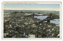
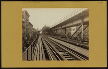
Bird's-eye view from Singer T…
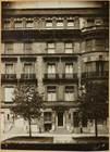
Row houses
m
Manhattan: 29th Street (East)…
m
Manhattan: 2nd Avenue - 57th …
m
Manhattan: 2nd Avenue - 61st …
m
Manhattan: 2nd Avenue - 61st …
m
Manhattan: 2nd Avenue - 61st …
m
Manhattan: 2nd Avenue - 61st …
m
Manhattan: 2nd Avenue - 62nd …
m
Manhattan: 2nd Avenue - 62nd …
m
Manhattan: 2nd Avenue - 62nd …
m
Manhattan: 5th Avenue - 43rd …
m
Manhattan: 5th Avenue - 43rd …
m
Manhattan: 5th Avenue - 43rd …
m
Manhattan: 5th Avenue - 43rd …
m
Manhattan: 5th Avenue - 43rd …
1
2
3
4
5
6
7
Previous
Next
1
2
3
4
5
6
7
Previous
Next