Click to visit the main New York Public Library Homepage
The New York Public Library
Digital Collections
About Digital Collections
Browse
Search only public domain materials
Items
Collections
Divisions
Home
Search
Browse
About
Search only public domain materials
Items
Collections
Divisions
Digital Collections
Using Images
Using Data
Search
Filtered search
Show filters
Hide filters
Show Only Public Domain
topic
Real property
4445
Fire insurance
3261
Cities & towns
3260
Maps
185
Zoning
111
More
Less
name
Sanborn Map Company
3271
G.W. Bromley & Co
1083
New York (N.Y.). Board of Estimate and Apportionment
224
Fairchild Aerial Camera Corporation
127
New York (N.Y.). Bureau of Engineering
127
More
Less
collection
Atlases of New York City
4897
Atlases of the United States
145
Maps of New York City and State
104
Robert N. Dennis collection of stereoscopic views
18
Atlases, gazetteers, guidebooks and other books
2
More
Less
place
New York (State)
4573
New York
1212
Manhattan (New York, N.Y.)
913
New York (N.Y.)
548
Bronx (New York, N.Y.)
187
More
Less
genre
Maps
5107
Atlases
141
Topographic maps
29
Indexes
28
Index maps
26
More
Less
publisher
Sanborn Map Company
3260
G.W. Bromley & Co
1083
New York (N.Y.). Board of Estimate and Apportionment
148
M.B. Brown Printing & Binding Co.,
111
E. Belcher Hyde
59
More
Less
division
x
Map Division
Wallach Division: Photography Collection
18
type
cartographic
5135
text
59
still image
22
Date Range
to
5,173 results found
Filtering on:
x
Date
: 1919 - 1940
x
Division
: Map Division
Sort by:
Title
Date created
Date digitized
Sequence
Paris, ses monuments : guide …
m
Il dirigibile "Norge" alla sc…
m
Hammond's complete map of Bro…
Map of the borough of Brookly…
Hammond's handy reference map…
m
Freight map of the metropolit…
Map of New York City and vici…
Educational extension work of…
Map of the comprehensive plan…
m
The John Wanamaker automobile…
Railroads in Manhattan, Jerse…
Map of the suburban territory…
Brooklyn, from Rand McNally m…
Hagstrom's map of lower New Y…
Rand McNally official 1921 au…
Hammond's handy reference map…
Map showing suggested connect…
Wall St. New York City, U.S.A…
Most extraordinary [camera sh…
Brooklyn Liberty Loan Committ…
Map of the borough of Brookly…
m
Map showing 50 miles around N…
Port of New York Authority : …
m
Proposed belt lines for the P…
Hagstrom's map of 50 mile rad…
Street guide of Brooklyn : wi…
American Automobile Associati…
Rand Mcnally official detaile…
m
Rand McNally official motor g…
m
Map of the borough of Brookly…
Transportation lines connecti…
m
The Wanamaker diary map of Ne…
m
Hagstrom's map of upper New Y…
The Narrows tunnel : chart of…
Proposed location of the Narr…
Hagstrom's New York house-num…
m
Financial district map of New…
Map of the borough of Manhatt…
Freight terminal map of the P…
Block no. 86 : confidential r…
m
Street guide of Manhattan and…
Greater New York's Census dis…
m
Hudson River vehicular tunnel…
Hagstrom's map of ... New Yor…
m
Map of original grants and fa…
m
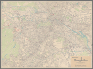
Olympia stadtplan von Berlin
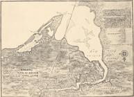
aert vande Svyd Rivier in Nie…
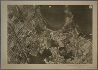
9B - N.Y. City (Aerial Set).
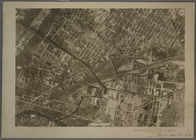
9C - N.Y. City (Aerial Set).
9D - N.Y. City (Aerial Set).
1
2
3
4
5
6
7
8
9
10
…
20
21
Previous
Next
1
2
3
4
5
6
7
8
9
10
…
20
21
Previous
Next