Click to visit the main New York Public Library Homepage
The New York Public Library
Digital Collections
About Digital Collections
Browse
Search only public domain materials
Items
Collections
Divisions
Home
Search
Browse
About
Search only public domain materials
Items
Collections
Divisions
Digital Collections
Using Images
Using Data
Search
Filtered search
Show filters
Hide filters
Show Only Public Domain
topic
Real property
58
Nautical charts
54
Road maps
53
History
44
Railroads
35
More
Less
name
Thornton, Samuel
75
Tiebout, Cornelius, 1777-1832
54
Colles, Christopher, 1738-1816
53
Carey, Mathew, 1760-1839
36
United States Coast Survey
19
More
Less
collection
Maps of North America
196
Lawrence H. Slaughter Collection of English maps, charts, globes, books and atlases
151
Maps of New York City and State
137
Atlases, gazetteers, guidebooks and other books
91
Atlases of the United States
60
More
Less
place
New York (State)
141
United States
130
New York (N.Y.)
84
Middle Atlantic States
74
New Jersey
47
More
Less
genre
x
Maps
Nautical charts
89
Atlases
60
Topographic maps
10
Cadastral maps
8
More
Less
publisher
M. Carey
27
publisher not identified
21
s.n
15
E. Robinson Co
14
Published by A.T. Goodrich, 124 Broad Way
14
More
Less
division
x
Map Division
type
cartographic
686
still image
17
text
10
Date Range
to
698 results found
Filtering on:
x
Division
: Map Division
x
Genre
: Maps
x
Note
: A. L. S. Endorsed: "Letter from Col. Atlee Augt. 1776." 1 page. 8o
Sort by:
Title
Date created
Date digitized
Sequence
A new and correct map of the …
Brooklyn, from Rand McNally m…
Hagstrom's map of 50 mile rad…
Map showing the present dista…
Map of the Harlem River and S…
m
Data for population from cens…
m
Topographical map of the city…
Atlas of the Oranges embracin…
The northwesterly part of the…
Southern part of the borough …
A map of the world from the b…
South America from the latest…
Nigritia and Guinea; with the…
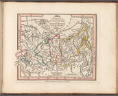
Siberia or Russian Tartary or…
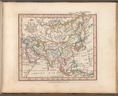
Asia from the latest observat…
Map of the boundary lines bet…
Map showing the New York and …
The northern route from Bosto…
Map showing route of marches …
Map of the survey of Wissahic…
Sketch I, showing the progres…
m
Map of 45 lots of ground leas…
m
Map & plan of the contemplate…
Map & plan of the contemplate…
Map of the White Mountains of…
A compleat map of North-Carol…
Map of Philadelphia photograp…
Map of Philadelphia photograp…
m
Map showing land grant of Nor…
m
Copy of section of photograph…
Grundriss des nördlichen Thei…
Plan von den Operationen der …
A sketch of the siege of Fort…
A sketch of the operations of…
Map of New York City and of M…
Plan of the Battle of Long Is…
A plan of New York Island, pa…
m
Map of the vicinity of Philad…
m
Map [of the republic] of Texa…
Barometric profile of the rou…
Design map of the village of …
m
A correct map of the state of…
Map of roads from Fort Dodge,…
Map no. 1 from San Francisco …
Map of a reconnaissance from …
Chart of the Columbia River f…
m
Map of Oregon and upper Calif…
Geological plan & section fro…
Geological section from the C…
Reconnaissance of the western…
1
2
3
Previous
Next
1
2
3
Previous
Next