Click to visit the main New York Public Library Homepage
The New York Public Library
Digital Collections
About Digital Collections
Browse
Search only public domain materials
Items
Collections
Divisions
Home
Search
Browse
About
Search only public domain materials
Items
Collections
Divisions
Digital Collections
Using Images
Using Data
Search
Filtered search
Show filters
Hide filters
Show Only Public Domain
topic
Nautical charts
2
Indians of North America
1
Pilot guides
1
name
Hooker, William
2
Blunt, Edmund M. (Edmund March), 1770-1862
1
Blunt, Edmund, 1799-1866
1
Blunt, G. W. (George William), 1802-1878
1
Bowles, Carington, 1724-1793
1
More
Less
collection
Lawrence H. Slaughter Collection of English maps, charts, globes, books and atlases
2
Maps of New York City and State
2
place
x
New York (N.Y.)
Connecticut
4
Long Island Sound (N.Y. and Conn.)
2
New Jersey
2
Atlantic Coast (North America)
1
More
Less
genre
Maps
4
publisher
Printed for the proprietor Carington Bowles No. 69 in St. Pauls Church Yard,
1
Pub. by E.M. Blunt for W. Hooker
1
Published & sold by E. & G.W. Blunt, 179 Water Street, corner of Burling Slip,
1
division
x
Map Division
type
cartographic
4
Date Range
to
4 results found
Filtering on:
x
Division
: Map Division
x
Place
: New York (N.Y.)
x
Place
: Connecticut
Sort by:
Title
Date created
Date digitized
Sequence
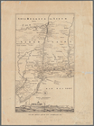
Van Der Donck's map of New Ne…
Bowles's new pocket map of th…
Chart of Long Island Sound, 1…
Long Island Sound from New Yo…