Click to visit the main New York Public Library Homepage
The New York Public Library
Digital Collections
About Digital Collections
Browse
Search only public domain materials
Items
Collections
Divisions
Home
Search
Browse
About
Search only public domain materials
Items
Collections
Divisions
Digital Collections
Using Images
Using Data
Search
Filtered search
Show filters
Hide filters
Show Only Public Domain
topic
Nautical charts
4
Coasts
2
Atlases, British
1
Beavers
1
Blacks
1
More
Less
name
Moll, Herman, -1732
2
W. & J. Mount & T. Page
2
Bassett, Thomas
1
Bellin, Jacques Nicolas, 1703-1772
1
Bowles, John, 1701-1779
1
More
Less
collection
Lawrence H. Slaughter Collection of English maps, charts, globes, books and atlases
5
Maps of North America
5
John H. Levine Collection
2
place
x
New York (N.Y.)
New England
12
New Jersey
7
Maps
4
Pennsylvania
4
More
Less
genre
Maps
12
publisher
... Sold ... by Tho. Bowles, print and map-seller in St. Paul's-Churchyard
1
Bellin
1
Ex officina N. Visscher
1
Marco Coltellini?
1
Printed and sold by Wm. Herbert under the Piazzas on London Bridge & Robt. Sayer facing Fetter Lane, Fleet Street
1
More
Less
division
x
Map Division
type
cartographic
12
Date Range
to
12 results found
Filtering on:
x
Division
: Map Division
x
Place
: New York (N.Y.)
x
Place
: New England
Sort by:
Title
Date created
Date digitized
Sequence
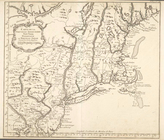
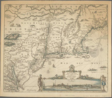
A Chart of ye coast of New En…
A chart of the sea coast of N…
A new map of New England and …
m
A new and exact map of the do…
A map of New England, New Yor…
A chart of the sea coast of N…
An actual survey of the sea c…
Belgii novi, angliae novae, e…
Carta della Nuova Inghilterra…
A map of New England and New …
Carte de la Nouvelle Angleter…
Novi Belgii Novaeque Angliae …
End of results
|
Top