Click to visit the main New York Public Library Homepage
The New York Public Library
Digital Collections
About Digital Collections
Browse
Search only public domain materials
Items
Collections
Divisions
Home
Search
Browse
About
Search only public domain materials
Items
Collections
Divisions
Digital Collections
Using Images
Using Data
Search
Filtered search
Show filters
Hide filters
Show Only Public Domain
topic
History
3
Atlases, British
2
Early works to 1800
2
Maps
2
Campaigns
1
More
Less
name
Bowles, John, 1701-1779
2
Faden, William, 1749-1836
2
Kitchin, Thomas, 1718-1784
2
Moll, Herman, -1732
2
American Revolution (1775-1783)
1
More
Less
collection
Maps of North America
7
Lawrence H. Slaughter Collection of English maps, charts, globes, books and atlases
3
place
x
Southern States
Florida
3
Caribbean Area
2
Gulf Coast (U.S.)
2
Maps
2
More
Less
genre
Maps
10
publisher
Faden
1
For R. Baldwin
1
J. Seller
1
Printed for R. Phillips, 71 St. Paul's Church Yard
1
Printed for Robert Morden and Thomas Cockeril, at the Atlas in Cornhill, and at the Three Legs in the Poultrey, over against the Stocks-Market
1
More
Less
division
x
Map Division
type
cartographic
10
Date Range
to
10 results found
Filtering on:
x
Division
: Map Division
x
Place term
: London
x
Place
: Southern States
Sort by:
Title
Date created
Date digitized
Sequence
Plan of the siege of York Tow…
Carolina
Map of the Province of West F…
A map of the new governments …
Florida, called by ye French …
A new map of the Cherokee Nat…
The marches of Lord Cornwalli…
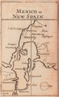
Mexico, or, New Spain
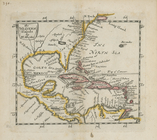
The Western Ilands
Map of the southern provinces…
Filter
x
Sorry. Nothing matches your entry
Feedback
Close
Feedback
Thank you!
Comment
Correction
Bug
400
Take a survey
Send
Please wait...
Thank you for helping the Library.
Close