Click to visit the main New York Public Library Homepage
The New York Public Library
Digital Collections
About Digital Collections
Browse
Search only public domain materials
Items
Collections
Divisions
Home
Search
Browse
About
Search only public domain materials
Items
Collections
Divisions
Digital Collections
Using Images
Using Data
Search
Filtered search
Show filters
Hide filters
Show Only Public Domain
topic
Nautical charts
4
Harbors
3
Access
1
Coasts
1
Fortification
1
More
Less
name
Andrews, Peter, fl. 1765-1782
2
Dury, Andrew
2
Montrésor, John, 1736-1799
2
Bew, John, d. 1793
1
Herbert, William, 1718-1795
1
More
Less
collection
Lawrence H. Slaughter Collection of English maps, charts, globes, books and atlases
3
Maps of New York City and State
2
Cartographic materials from the Emmet collection of manuscripts etc. relating to American history
1
Maps of North America
1
place
x
New York Harbor (N.Y. and N.J.)
New York (N.Y.)
4
Manhattan (New York, N.Y.)
3
New Jersey
3
New York
2
More
Less
genre
Maps
7
Keys (Legends)
1
publisher
Sold by A. Dury, Dukes Court, St. Martins Lane
2
J.H. Colton & Co
1
Port of New York Authority
1
Printed and sold by Wm. Herbert under the Piazzas on London Bridge & Robt. Sayer facing Fetter Lane, Fleet Street
1
Published ... by J. Bew, Pater Noster Row
1
More
Less
division
x
Map Division
type
cartographic
7
text
1
Date Range
to
7 results found
Filtering on:
x
Division
: Map Division
x
Language term
: English
x
Place
: New York Harbor (N.Y. and N.J.)
Sort by:
Title
Date created
Date digitized
Sequence
m
Proposed belt lines for the P…
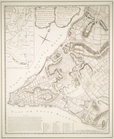
Map of the port & vicinity of…
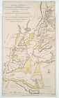
A plan of the city of New-Yor…
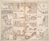
Les principales forteresses, …
A plan of the city of New-Yor…
An actual survey of the sea c…
Chart and plan of the harbour…