Click to visit the main New York Public Library Homepage
The New York Public Library
Digital Collections
About Digital Collections
Browse
Search only public domain materials
Items
Collections
Divisions
Home
Search
Browse
About
Search only public domain materials
Items
Collections
Divisions
Digital Collections
Using Images
Using Data
Search
Filtered search
Show filters
Hide filters
Show Only Public Domain
topic
Atlases, British
1
Beavers
1
Boundaries
1
Colonies
1
Discovery and exploration
1
More
Less
name
Arrowsmith, John, 1790-1873
1
Bowles, John, 1701-1779
1
Bowles, Thomas, 1694-1773
1
Bowles, Thomas, 1694-1773
1
Great Britain
1
More
Less
collection
Maps of North America
8
Lawrence H. Slaughter Collection of English maps, charts, globes, books and atlases
2
place
x
Canada
North America
4
America
3
New England
3
Newfoundland and Labrador
3
More
Less
genre
Maps
10
publisher
... Sold ... by Tho. Bowles, print and map-seller in St. Paul's-Churchyard
1
J. Arrowsmith
1
J. Seller
1
Laurie & Whittle
1
Maclure & Macdonald Lithrs. to the Queen
1
More
Less
division
x
Map Division
type
cartographic
10
Date Range
to
10 results found
Filtering on:
x
Division
: Map Division
x
Place term
: London
x
Place
: Canada
Sort by:
Title
Date created
Date digitized
Sequence
Part of North America, contai…
m
A map of Cabotia: comprehendi…
The San Juan award: a map sho…
m
A new and exact map of the do…
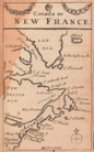
Canada, or, New France
British possessions in North …
A Map of the frontier of Brit…
An accurate map of Canada, wi…
British North America
A New and correct map of the …