Click to visit the main New York Public Library Homepage
The New York Public Library
Digital Collections
About Digital Collections
Browse
Search only public domain materials
Items
Collections
Divisions
Home
Search
Browse
About
Search only public domain materials
Items
Collections
Divisions
Digital Collections
Using Images
Using Data
Search
Filtered search
Show filters
Hide filters
Show Only Public Domain
topic
History
127
Description and travel
33
Nautical charts
9
Colonies
4
Islands
4
More
Less
name
Austro-Hungarian Monarchy. Militärgeographisches Institut
773
Montanus, Arnoldus, 1625?-1683
115
Ogilby, John, 1600-1676
115
Green, John, fl. 1730-1753
55
Astley, Thomas, -1839
53
More
Less
collection
Spezialkarte der Osterreichisch-Ungarischen Monarchie
773
Lawrence H. Slaughter Collection of English maps, charts, globes, books and atlases
122
I. N. Phelps Stokes Collection of American Historical Prints
83
A new general collection of voyages and travels: consisting of the most esteemed relations, which have been hitherto published in any language; comprehending everything remarkable in its kind, in Europe, Asia, Africa, and America
55
Umbstandliche und eigentliche Beschreibung von Africa
14
More
Less
place
America
129
West Indies, British
116
Africa
30
New York (N.Y.)
29
North America
14
More
Less
genre
x
Maps
Topographic maps
773
Prints
191
Illustrations
43
Plans
10
More
Less
publisher
K.u.K. Militargeographisches Institut
773
Printed by the author, and are to be had at his house
117
Printed for T. Astley
55
Jacob von Meurs
14
Harper & Brothers
7
More
Less
division
Map Division
914
Wallach Division: Print Collection
87
Rare Book Division
80
General Research Division
33
Schomburg Manuscripts, Archives and Rare Books Division
17
More
Less
type
cartographic
1035
still image
134
text
9
Date Range
to
1,137 results found
Filtering on:
x
Form
: Engravings
x
Genre
: Maps
x
Rights
: Public Domain
Sort by:
Title
Date created
Date digitized
Sequence
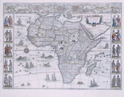
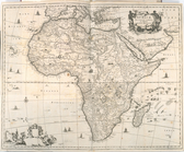
Africæ: nova descriptio
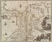
Oud-Groenland, of deszelfs Oo…
A plan of the city of New Yor…
Le Ruyavme d Abyssinie ou lem…
L"empire du Monomotapa et la …
Isle de Malthe
Isle de Madagascar dite de St…
Isles dv Cap Verd
I. Goree
Afrique Ancienne
Afrique Moderne
Partie Septentrionale de L'An…
Congo
Africae Accurata Tabula ex Of…
Nova Aegypti Tabula
Barbaria Biledulgered o: Liby…
Fezzae et Marocchi Regna Afri…
Nigritarum Regio
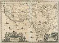
Gvinea
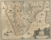
Aethiopia Inferior vel Exteri…
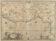
Regna Congo et Angola
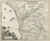
Aethiopia Superior vel Interi…
Insvla S. Lavrentii, vulgo Ma…
Insula Promontorii Viridis, H…
Insula Canariae alias Fortuna…
Melite Insula vulgo Masia
Difegno Della Citta Valletta
A Map or North East and North…
m
Greenland
Plan du port, ville, citadell…
Vid osady Novgoroda iz Videki…
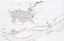
Great Falls of Columbia River
Koningsberga
St. Johann im Pongau
A new and correct map of the …
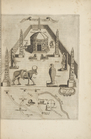
Pianta del reale giardino di …
Le Kaire et ses environs
Gviana siue Amazona Regia. [d…
Terra firma et novum regnum G…
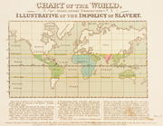
Chart of the world, on Mercat…
Egtypon Isaei. Ichonographia …
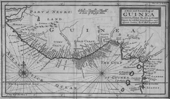
A New and Exact Map of Guinea…
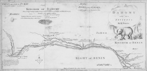
Dahomy and its environs by R.…
The Nile, from Assuan to the …
General plan of the pyramids …
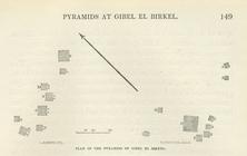
Plan of the pyramids of Gibel…
A new and correct map of Conn…
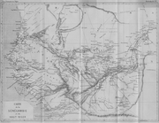
Carte de la Sénégambie et du …
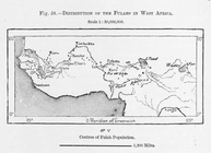
Distribution of Fulahs in Wes…
m
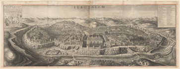
View of Jerusalem
1
2
3
4
5
Previous
Next
1
2
3
4
5
Previous
Next