Click to visit the main New York Public Library Homepage
The New York Public Library
Digital Collections
About Digital Collections
Browse
Search only public domain materials
Items
Collections
Divisions
Home
Search
Browse
About
Search only public domain materials
Items
Collections
Divisions
Digital Collections
Using Images
Using Data
Search
Filtered search
Show filters
Hide filters
Show Only Public Domain
topic
Indians of North America
3
Maps
3
Early works to 1800
2
Facsimiles
2
Administrative and political divisions
1
More
Less
name
Brodhead, John Romeyn, 1814-1873
2
Bancker, Gerard, 1740-1799
1
Bien, Julius, 1826-1909
1
Cockburn, William
1
Colles, Christopher, 1738-1816
1
More
Less
collection
Maps of New York City and State
8
Maps of North America
3
place
New York (State)
5
New England
3
New Jersey
2
New Netherland
2
Atlantic Provinces
1
More
Less
genre
x
Facsimiles
Maps
11
Early maps
3
Early works to 1800
3
Manuscript maps
3
More
Less
publisher
publisher not identified
4
B.F. Stevens
1
Geological Survey of New Jersey
1
Office of the New England Historical and Genealogical Register?
1
Publisher not identified
1
More
Less
division
Map Division
11
type
cartographic
11
Date Range
to
11 results found
Filtering on:
x
Genre
: Facsimiles
x
Place
: ('geographic', "Mcgowan's Pass (New York, N.Y.)")
Sort by:
Title
Date created
Date digitized
Sequence
New York to New Rochelle: fro…
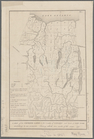
The Province of New Jersey : …
Map of New England
Map of New York, New England,…
m
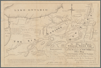
To his excellency William Try…
Map of New Netherland which w…
Map of New Netherland
m
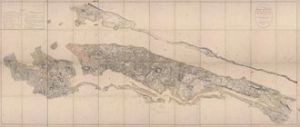
Map of Long Island and adjace…
The south part of New-England…
A map of the Genesee lands in…
m
Facsimile of the unpublished …
End of results
|
Top