Click to visit the main New York Public Library Homepage
The New York Public Library
Digital Collections
About Digital Collections
Browse
Search only public domain materials
Items
Collections
Divisions
Home
Search
Browse
About
Search only public domain materials
Items
Collections
Divisions
Digital Collections
Using Images
Using Data
Search
Filtered search
Show filters
Hide filters
Show Only Public Domain
topic
Description and travel
16
Real property
15
History
14
Landowners
13
Administrative and political divisions
5
More
Less
name
Green, John, fl. 1730-1753
12
Astley, Thomas, -1839
11
Jomard, M. (Edme-François), 1777-1862
8
Napoleon I, Emperor of the French, 1769-1821
8
Catherwood, Frederick
6
More
Less
collection
Maps of North America
36
A new general collection of voyages and travels: consisting of the most esteemed relations, which have been hitherto published in any language; comprehending everything remarkable in its kind, in Europe, Asia, Africa, and America
12
Description de l'Égypte: ou, Recueil des observations et des recherches qui ont été faites en Égypte pendant l'expédition de l'armée française
8
Incidents of travel in Yucatan: By John L. Stephens ... Illustrated by 120 engravings...
6
Description de l'univers ..
5
More
Less
place
United States
15
Egypt
13
Africa
12
Ohio
8
California
6
More
Less
genre
x
Maps
Illustrations
130
Prints
40
Cadastral maps
13
Plans
7
More
Less
publisher
Harper & Brothers
12
Printed for T. Astley
12
Impr. impériale
8
D. Thierry
5
T. Amaulry
5
More
Less
division
Rare Book Division
43
Map Division
39
Schomburg Manuscripts, Archives and Rare Books Division
19
Schomburg Jean Blackwell Hutson Research and Reference Division
16
General Research Division
7
More
Less
type
cartographic
125
still image
64
text
13
Date Range
to
130 results found
Filtering on:
x
Genre
: Maps
x
Genre
: Illustrations
x
Rights
: Public Domain
Sort by:
Title
Date created
Date digitized
Sequence
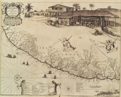
Le Ruyavme d Abyssinie ou lem…
L"empire du Monomotapa et la …
Isle de Malthe
Isle de Madagascar dite de St…
Isles dv Cap Verd
I. Goree
Afrique Ancienne
Afrique Moderne
Partie Septentrionale de L'An…
Congo
Tabula Nautica.
Turkey III: containing the So…
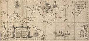
Kaert von Groen-Land, [fold o…
m
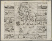
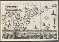
Greenland
Præfecturæ Paranambucæ par bo…
Ethnological Chart of the Wor…
Sevilla
Vilna Litvaniae
Map of the New World
m
Cosmographey oder beschreibun…
Siege of Fort Meigs
Detroit River and vicinity
Plan of the Tippecanoe camp a…
Plan of the Battle of Fallen …
Battle of the Thames
Plan of the city of Philadelp…
Map of free states, slave sta…
Egtypon Isaei. Ichonographia …
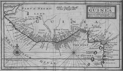
A New and Exact Map of Guinea…
m
With the 114th in the ETO: A …
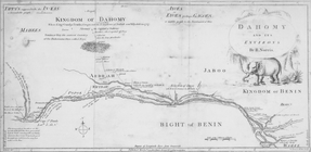
Dahomy and its environs by R.…
The Nile, from Assuan to the …
General plan of the pyramids …
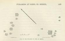
Plan of the pyramids of Gibel…
New and improved map of the c…
Our centennial--plan of the g…
m
Topographical map of the coun…
A new and correct map of Conn…
m
Florance, George N
Plan of the city of Philadelp…
m
City of Toledo, Lucas Co., Oh…
Map of Cleveland and its envi…
Map of the city of Cleveland,…
m
A correct map of the state of…
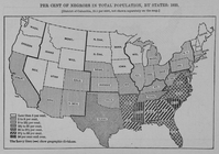
Per cent of Negroes in total …
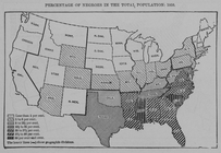
Percentage of Negroes in the …
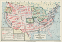
Status of slavery in the Unit…
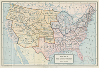
The United States, March 4, 1…
m
Rand, McNally & Co.'s new bus…
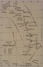
Map of the Lesser Antilles