Click to visit the main New York Public Library Homepage
The New York Public Library
Digital Collections
About Digital Collections
Browse
Search only public domain materials
Items
Collections
Divisions
Home
Search
Browse
About
Search only public domain materials
Items
Collections
Divisions
Digital Collections
Using Images
Using Data
Search
Filtered search
Show filters
Hide filters
Show Only Public Domain
topic
History
46
Canals
3
Campaigns
2
Fortification
2
Fredericksburg, Battle of, Fredericksburg, Va., 1862
2
More
Less
name
United States. Army. Corps of Topographical Engineers
14
American Civil War (1861-1865)
13
Humphreys, A. A. (Andrew Atkinson), 1810-1883
5
United States Coast Survey
5
United States. Army of the Potomac. Office of Surveys and Maps
5
More
Less
collection
Maps of North America
48
Lawrence H. Slaughter Collection of English maps, charts, globes, books and atlases
6
A military and topographical atlas of the United States; including the British possessions & Florida
1
Atlases of the United States
1
The generall historie of Virginia, New-England, and the Summer Isles: with the names of the adventurers, planters, and governours from their first beginning, año: 1584. to this present 1626. With the proceedings of those severall colonies and the accidents that befell them in all their journyes and discoveries. Also the maps and descriptions of all those countryes, their commodities, people, government, customes, and religion yet knowne. Divided into sixe bookes
1
More
Less
place
x
Virginia
United States
58
Maryland
10
Richmond (Va.)
10
Fredericksburg (Va.)
9
More
Less
genre
x
Maps
Manuscript maps
5
Military maps
3
Early maps
1
Early works to 1800
1
More
Less
publisher
Corps of Topographical Engineers
8
Office of Surveys and Maps, Army of the Potomac
4
U.S. Coast Survey Office
4
Albemarle and Chesapeake Canal Company
2
Buisson,
2
More
Less
division
Map Division
55
Rare Book Division
2
Wallach Division: Picture Collection
1
type
cartographic
57
still image
1
Date Range
to
58 results found
Filtering on:
x
Genre
: Maps
x
Place
: Virginia
x
Place
: United States
Sort by:
Title
Date created
Date digitized
Sequence
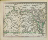
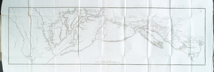
Map of Virginia, Maryland and…
Map of the American Coast, fr…
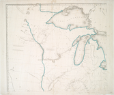
Map of the frontiers of the n…
Sketch exhibiting the approac…
Map of Richmond, Virginia and…
Map of the Albemarle and Ches…
Map of the City of Richmond, …
Map of part of Virginia, Mary…
Map of Virginia showing the d…
Central Virginia : showing Li…
Map of York River, Virginia :…
Loudon County, Virginia
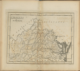
Middle Virginia and North Car…
Military map refering to the …
Johnson's map of the vicinity…
Colton's new topographical ma…
Pictorial map of the seat of …
m
Map of part of Virginia, Mary…
Map of eastern Virginia : com…
Military map of south-eastern…
Military map of south-eastern…
Albemarle and Chesapeake Cana…
Map of the vicinity of Richmo…
Map of Richmond, Virginia, an…
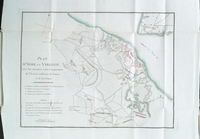
Plan of the siege of York Tow…
Eastern Virginia showing the …
Seat of war in Virginia : she…
Strategic war points of the U…
Albemarle and Chesapeake Cana…
Noua Terrae-Mariae tabula
Map of part of Virginia, Nort…
Map of field of occupation, A…
Map showing the approaches to…
Map of Virginia, Fredericksbu…
Map of a portion of Virginia:…
m
The position of Yorktown with…
m
Dec. 13th Positions of Humphr…
Map of field of occupation of…
m
Vicinity of the Rapidan and R…
Battle of Rappahannock Statio…
Sketch exhibiting the positio…
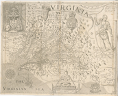
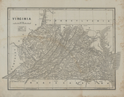
Virginia
United States of Nth. America…
Virginia
Virginia, Maryland, and Delaw…
Côte de York-town à Boston : …
Plan d'York en Virginie, avec…
Virginia
Map of Loudon [sic], Jefferso…
m
Sketch of the battle of Frede…