Click to visit the main New York Public Library Homepage
The New York Public Library
Digital Collections
About Digital Collections
Browse
Search only public domain materials
Items
Collections
Divisions
Home
Search
Browse
About
Search only public domain materials
Items
Collections
Divisions
Digital Collections
Using Images
Using Data
Search
Filtered search
Show filters
Hide filters
Show Only Public Domain
topic
Railroads
2
Boundaries
1
Harbors
1
Nautical charts
1
name
Rand McNally and Company
2
Graham, J. D. (James Duncan), 1799-1865
1
Imray, James F. (James Frederick), 1829?-1891
1
United States. Army. Corps of Topographical Engineers
1
Von Tempsky, G. F. (Gustavus Ferdinand), 1828-1868
1
More
Less
collection
Maps of North America
4
Mitla. A narrative of incidents and personal adventures on a journey in Mexico, Guatemala, and Salvador in the years of 1853 to 1855. With observations on the modes of life in those countries. By. G. F. von Tempsky. Edited by J. S. Bell ..
1
place
x
Mexico
United States
3
Canada
2
California
1
California, Gulf of
1
More
Less
genre
x
Maps
Charts
1
Diagrams
1
Nautical charts
1
Prints
1
publisher
Rand, McNally & Co
2
James Imray, chart and nautical book publishers, 102 Minories
1
Longman, Brown, Green, Longmans, & Roberts
1
U.S. Army Corps of Topographical Engineers
1
division
Map Division
4
General Research Division
1
type
cartographic
5
still image
1
Date Range
to
5 results found
Filtering on:
x
Genre
: Maps
x
Note
: Inscribed "to S. Watson from Johns Fergusson."
x
Place
: Mexico
Sort by:
Title
Date created
Date digitized
Sequence
Barometric profile of the rou…
Rand McNally & Co.'s new offi…
Rand McNally & Co.'s new offi…
Chart of the coast of Califor…
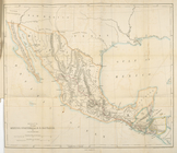
Route through Mexico, Guatema…