Click to visit the main New York Public Library Homepage
The New York Public Library
Digital Collections
About Digital Collections
Browse
Search only public domain materials
Items
Collections
Divisions
Home
Search
Browse
About
Search only public domain materials
Items
Collections
Divisions
Digital Collections
Using Images
Using Data
Search
Filtered search
Show filters
Hide filters
Show Only Public Domain
topic
x
Early works to 1800
Maps
3
Description and travel
2
Cherokee Indians
1
Land tenure
1
name
Carver, Jonathan, 1710-1780
2
Hinton, John, -1781
1
Kitchin, Thomas, 1718-1784
1
Phillips, R
1
Russell, John, active 1733-1795
1
collection
Maps of North America
2
Travels through the interior parts of North-America in theyears 1766, 1767, and 1768
2
Maps of New York City and State
1
place
Northwestern States
2
Southern States
2
United States
2
New York (State)
1
North America
1
genre
x
Maps
publisher
Printed for the author, and sold by J. Walter [etc.]
2
For R. Baldwin
1
J. Hinton
1
Printed for R. Phillips, 71 St. Paul's Church Yard
1
division
Map Division
3
Rare Book Division
2
type
cartographic
5
Date Range
to
5 results found
Filtering on:
x
Genre
: Maps
x
Place term
: London
x
Topic
: Early works to 1800
Sort by:
Title
Date created
Date digitized
Sequence
A new map of North America fr…
A plan of Captain Carvers tra…
A new map of the Cherokee Nat…
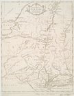
An Accurate map of New York i…
Map of the southern provinces…