Click to visit the main New York Public Library Homepage
The New York Public Library
Digital Collections
About Digital Collections
Browse
Search only public domain materials
Items
Collections
Divisions
Home
Search
Browse
About
Search only public domain materials
Items
Collections
Divisions
Digital Collections
Using Images
Using Data
Search
Filtered search
Show filters
Hide filters
Show Only Public Domain
topic
Real property
7
Landowners
2
Real propery auctions
2
name
G.W. Bromley & Co
4
A.H. Mueller (Publisher)
1
James Bleecker & Sons
1
Robinson, E. (Elisha)
1
collection
Atlases of New York City
4
Collection of broadside real estate maps announcing auctions of lots in early 19th century New York City
2
Atlases of the United States
1
place
New York (N.Y.)
4
Queens (New York, N.Y.)
4
Manhattan (New York, N.Y.)
2
New York
2
New York (State)
2
More
Less
genre
x
Cadastral maps
Maps
7
Atlases
1
publisher
G. W. Bromley & Co
4
A.H. Mueller
1
division
Map Division
6
Milstein Division
1
type
cartographic
7
Date Range
to
7 results found
Filtering on:
x
Genre
: Cadastral maps
x
Note
: "Perlstein Jun 18, 1931."
Sort by:
Title
Date created
Date digitized
Sequence
m
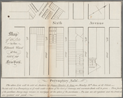
Map of 19 lots in the fifteen…
m
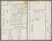
Map of a water grant between …
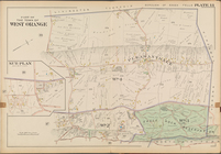
Part of the town of West Oran…
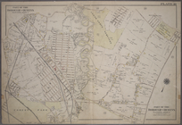
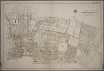
Plate 18: Bounded by Remsen S…
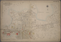
Plate 21: Bounded by (Mill Cr…
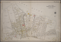
Plate 23: Bounded by (East Ri…
Plate 25: Bounded by (East Ri…