Click to visit the main New York Public Library Homepage
The New York Public Library
Digital Collections
About Digital Collections
Browse
Search only public domain materials
Items
Collections
Divisions
Home
Search
Browse
About
Search only public domain materials
Items
Collections
Divisions
Digital Collections
Using Images
Using Data
Search
Filtered search
Show filters
Hide filters
Show Only Public Domain
topic
Boundaries
1
History
1
name
Stone, William James, 1798-1865
2
Barralet, John James, approximately 1747-1815
1
Breese, Samuel, 1802-1873
1
Carrigain, Philip, 1772-1842
1
Des Barres, Joseph F. W. (Joseph Frederick Wallet), 1722-1824
1
More
Less
collection
Maps of North America
7
Atlases of the United States
1
place
x
United States
New Hampshire
8
Maine
5
Vermont
4
Canada
3
More
Less
genre
x
Maps
Pictorial works
1
Topographic maps
1
publisher
J.F.W. Des Barres
1
Laurie & Whittle
1
Philip Carrigain
1
Printed by order of the Senate of the U.S. of March 3d, 1843
1
S. E. Morse & co.,
1
More
Less
division
Map Division
8
type
cartographic
8
still image
1
Date Range
to
8 results found
Filtering on:
x
Genre
: Maps
x
Place
: United States
x
Place
: New Hampshire
Sort by:
Title
Date created
Date digitized
Sequence
Map of the boundary lines bet…
New Hampshire by recent survey
Mt. Washington and vicinity: …
m
Piscataqua Harbour, Portsmout…
m
A map of Cabotia: comprehendi…
Extract from a map of the Bri…
A new and accurate map of the…
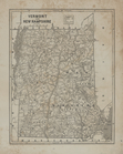
Vermont and New Hampshire.