Click to visit the main New York Public Library Homepage
The New York Public Library
Digital Collections
About Digital Collections
Browse
Search only public domain materials
Items
Collections
Divisions
Home
Search
Browse
About
Search only public domain materials
Items
Collections
Divisions
Digital Collections
Using Images
Using Data
Search
Filtered search
Show filters
Hide filters
Show Only Public Domain
topic
Colonies
2
History
2
Automobile travel
1
Geology
1
Real property
1
More
Less
name
Child, G
2
Popple, Henry, d. 1743
2
Back, Jean Conr. (Jean Conrad)
1
Barbot, Jean, 1655-1712
1
Bowen, Emanuel, d. 1767
1
More
Less
collection
Maps of North America
9
Cartographic materials from the Emmet collection of manuscripts etc. relating to American history
4
A new map of Africa from the best authorities
1
A particular map of the River Sanaga, from its desart to the Isle of Morfil or Ivory, including the Lake of Pania Fuli
1
Atlases of the United States
1
More
Less
place
North America
7
America
2
Great Britain
2
New Jersey
2
Africa
1
More
Less
genre
x
Maps
Guidebooks
1
publisher
x
s.n
division
Map Division
16
Schomburg Jean Blackwell Hutson Research and Reference Division
3
General Research Division
1
type
cartographic
20
still image
2
text
1
Date Range
to
20 results found
Filtering on:
x
Genre
: Maps
x
Language term
: English
x
Publisher
: s.n.
Sort by:
Title
Date created
Date digitized
Sequence
A new map of Africa from the …
Map of the village at Little …
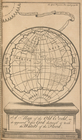
A map of the Old World, as it…
A new map of North America fr…
m
Locke's good road maps of loc…
A new and accurate map of the…
Map illustrating the general …
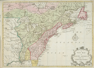
A map of the British Empire i…
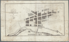
Plan of the town of Baltimore…
A map of the British and Fren…
A map of the British Empire i…
A new map of North America fr…
An accurate map of the Britis…
Western states
Map of part of the windward c…
A particular map of the River…
A chart of Delaware Bay and R…
A survey of the Northern Neck…
A map of that part of Pensylv…
A New and accurate map of the…
End of results
|
Top