Click to visit the main New York Public Library Homepage
The New York Public Library
Digital Collections
About Digital Collections
Browse
Search only public domain materials
Items
Collections
Divisions
Home
Search
Browse
About
Search only public domain materials
Items
Collections
Divisions
Digital Collections
Using Images
Using Data
Search
Filtered search
Show filters
Hide filters
Show Only Public Domain
topic
Real property
270
Fire insurance
86
Cities & towns
81
Administrative and political divisions
22
Railroads
22
More
Less
name
Sanborn Map Company
84
Everts, Ensign & Everts
48
Ullitz, Hugo
42
E.B. Hyde & Co
38
E. Belcher Hyde Map Company
33
More
Less
collection
Atlases of New York City
162
Atlases of the United States
124
Maps of New York City and State
108
Collection of broadside real estate maps announcing auctions of lots in early 19th century New York City
5
Lawrence H. Slaughter Collection of English maps, charts, globes, books and atlases
2
More
Less
place
x
New York (State)
New York
136
Brooklyn (New York, N.Y.)
79
New York (N.Y.)
65
Manhattan (New York, N.Y.)
47
More
Less
genre
x
Maps
Atlases
124
Cadastral maps
10
Manuscript maps
9
Indexes
2
More
Less
publisher
Sanborn Map Company
81
E. Belcher Hyde
36
F. W. Beers & Co
22
Everts, Ensign & Everts
18
Fairchild, John F
17
More
Less
division
Map Division
403
No Division
1
Rare Book Division
1
type
cartographic
400
text
6
still image
3
Date Range
to
405 results found
Filtering on:
x
Genre
: Maps
x
Note
: Inscribed "to S. Watson from Johns Fergusson."
x
Place
: New York (State)
Sort by:
Title
Date created
Date digitized
Sequence
m
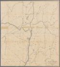
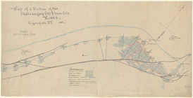
Maps of property in the city …
m
Map of property belonging to …
m
The John Wanamaker automobile…
m
Rand, McNally & Co.'s complet…
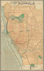
Brooklyn, from Rand McNally m…
Hagstrom's map of 50 mile rad…
Rand, McNally & Co.'s new han…
Rand McNally & Co.'s new hand…
Map showing the present dista…
Map of the Harlem River and S…
m
Rand McNally & Co.'s road map…
m
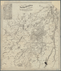
Watson's new map of New York …
m
Watson's new map of New York …
Map of portion of greater New…
m
Watson's new map of New York,…
The northwesterly part of the…
Southern part of the borough …
Map of the American Coast, fr…
Map of the boundary lines bet…
Map showing the New York and …
m
Map of 45 lots of ground leas…
m
Map of a water grant between …
Executors sale of valuable re…
m
Map & plan of the contemplate…
Map & plan of the contemplate…
Erie Canal enlargement, middl…
Plate I. Map of the watershed…
Northern coast of Long Island…
Rand, McNally & Co.'s indexed…
Map showing the rail roads wi…
The Matthews-Northrup Co.'s n…
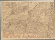
Rand, McNally & Co.'s New York
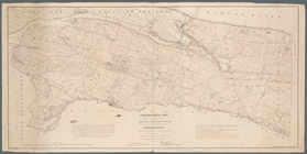
Topographical map made from s…
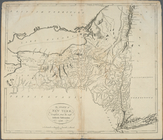
Map of the province of New Yo…
Map of a portion of the Chate…
Map of the New York wildernes…
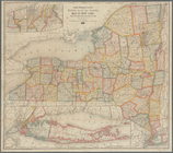
Rand, McNally & Co.'s New York
m
Map of Cayuga and Seneca Coun…
Rand McNally & Co.'s new rail…
Map of the New York wildernes…
The Hudson by daylight map fr…
Map of Byram River from its m…
Map of all points of interest…
La Pensilvania, la Nuova York…
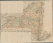
The state of New York, compil…
m
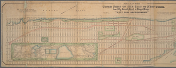
Map of the upper part of the …
m
Map[s] to accompany report "T…
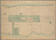
Map of New York City from 50t…
Map of West Street from Batte…
Paving map [Reade Street from…
1
2
Previous
Next
1
2
Previous
Next