Click to visit the main New York Public Library Homepage
The New York Public Library
Digital Collections
About Digital Collections
Browse
Search only public domain materials
Items
Collections
Divisions
Home
Search
Browse
About
Search only public domain materials
Items
Collections
Divisions
Digital Collections
Using Images
Using Data
Search
Filtered search
Show filters
Hide filters
Show Only Public Domain
topic
Coasts
3
Harbors
3
Landowners
2
Nautical charts
2
Administrative and political divisions
1
More
Less
name
A.B. Graham Co
1
Adams & Co
1
American Photo-Lithographic Company
1
American Revolution (1775-1783)
1
Armstrong, S. C. (Samuel Chapman), 1839-1893
1
More
Less
collection
Maps of North America
11
Atlases, gazetteers, guidebooks and other books
2
Lawrence H. Slaughter Collection of English maps, charts, globes, books and atlases
1
place
x
South Carolina
Charleston
2
Charleston Harbor (S.C.)
2
Charleston Region (S.C.)
2
North Carolina
2
More
Less
genre
x
Maps
Nautical charts
3
Bathymetric maps
2
publisher
publisher not identified
2
C.P. Wayne
1
Civil Engineer's Office
1
Foote & Davies Company
1
Gaylord Watson
1
More
Less
division
Map Division
14
type
cartographic
14
text
2
Date Range
to
14 results found
Filtering on:
x
Genre
: Maps
x
Note
: Inscribed "to S. Watson from Johns Fergusson."
x
Place
: South Carolina
Sort by:
Title
Date created
Date digitized
Sequence
Beaufort River, S.C. : from B…
To the Right Honourable Willi…
Map showing lands adjoining t…
Charleston harbour, S. Ca. : …
A bird's-eye view of the city…
Plan of the siege of Charlest…
A new and accurate map of the…
m
Watson and Adams new topograp…
Sketch E showing the progress…
Map of Marlboro County, S.C.
Map of Virginia and West Va.,…
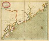
A chart of the sea coasts of …
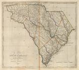
The State of South Carolina, …
A large draft of SOUTH CAROLI…
End of results
|
Top