Click to visit the main New York Public Library Homepage
The New York Public Library
Digital Collections
About Digital Collections
Browse
Search only public domain materials
Items
Collections
Divisions
Home
Search
Browse
About
Search only public domain materials
Items
Collections
Divisions
Digital Collections
Using Images
Using Data
Search
Filtered search
Show filters
Hide filters
Show Only Public Domain
topic
Antislavery movements
1
Atlases
1
Blacks
1
Colonies
1
Enslaved persons
1
More
Less
name
Bell, A. (Andrew), 1728-1779
1
Blaeu, Willem Janszoon, 1571-1638
1
Great Britain. Parliament
1
J. & C. Walker (Firm)
1
Keulen, Johannes van (fl. 1726-1753)
1
More
Less
collection
I. N. Phelps Stokes Collection of American Historical Prints
1
Lawrence H. Slaughter Collection of English maps, charts, globes, books and atlases
1
Map of the Old Continent exhibiting its greatest diametrical length from the point of East Tartary to the Cape of Good Hope
1
Renaissance and medieval manuscripts collection
1
Sidney Lapidus Slavery and Abolition Collection
1
place
x
Africa
Europe
5
Asia
2
Great Britain
2
America
1
More
Less
genre
Maps
4
Administrative acts
1
Manuscripts
1
Prints
1
Religious books
1
publisher
Chapman and Hall
1
Iohannus van Kuelen
1
Printed by George Edward Eyre and Andrew Spottiswoode, Printers to the Queen's most Excellent Majesty
1
s.n
1
division
Manuscripts and Archives Division
1
Map Division
1
Schomburg Jean Blackwell Hutson Research and Reference Division
1
Schomburg Manuscripts, Archives and Rare Books Division
1
Wallach Division: Print Collection
1
type
cartographic
4
text
2
still image
1
Date Range
to
5 results found
Filtering on:
x
Place
: Africa
x
Place
: Europe
Sort by:
Title
Date created
Date digitized
Sequence
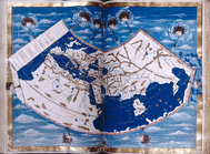
World on gnomonic projection …
m
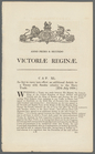
An act to carry into effect a…
m
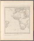
Map of Europe, Africa, the Me…
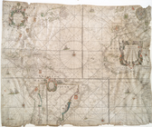
West-Indische paskaert....
Map of the Old Continent exhi…