Click to visit the main New York Public Library Homepage
The New York Public Library
Digital Collections
About Digital Collections
Browse
Search only public domain materials
Items
Collections
Divisions
Home
Search
Browse
About
Search only public domain materials
Items
Collections
Divisions
Digital Collections
Using Images
Using Data
Search
Filtered search
Show filters
Hide filters
Show Only Public Domain
topic
Coasts
3
Atlases, British
2
West Indies, British
2
Mail steamers
1
Steamboat lines
1
More
Less
name
Godbid, Anne
2
Jacobsz, Anthoni 1594-1624
2
Playford, John, ca. 1655-1685 or 6
2
Seller, John, fl. 1658-1698
2
Butterfield, Carlos
1
More
Less
collection
Lawrence H. Slaughter Collection of English maps, charts, globes, books and atlases
3
Maps of North America
3
place
x
Caribbean Area
Mexico, Gulf of
6
Atlantic Coast (North America)
4
West Indies
4
Central America
2
More
Less
genre
Maps
6
Portolan charts
2
publisher
Printed by A. Godbid and J. Playford, for John Seller ...,
2
Johnson & Browning
1
publisher not identified
1
s.n.,
1
division
Map Division
6
type
cartographic
6
text
1
Date Range
to
6 results found
Filtering on:
x
Place
: Caribbean Area
x
Place
: Mexico, Gulf of
Sort by:
Title
Date created
Date digitized
Sequence
Map of the United States and …
Americæ septentrionalis pars:…
Americae septentrionalis pars…
A new mapp of the Empire of M…
m
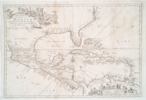
A chart of the West Indias fr…
m
A chart of the West Indias fr…