Click to visit the main New York Public Library Homepage
The New York Public Library
Digital Collections
About Digital Collections
Browse
Search only public domain materials
Items
Collections
Divisions
Home
Search
Browse
About
Search only public domain materials
Items
Collections
Divisions
Digital Collections
Using Images
Using Data
Search
Filtered search
Show filters
Hide filters
Show Only Public Domain
topic
Waterfronts
31
Nautical charts
22
Post roads
14
Railroads
10
Ships
9
More
Less
name
Sperr, Percy Loomis, 1890-1964
15
Bridges
14
Goodrich, A. T. (Andrew Thompson), 1789-1845
14
Rollinson, William, 1762-1842
14
Faden, William, 1749-1836
6
More
Less
collection
Maps of New York City and State
31
Photographic views of New York City, 1870's-1970's, from the collections of the New York Public Library
31
Lawrence H. Slaughter Collection of English maps, charts, globes, books and atlases
15
Atlases of the United States
14
Maps of North America
6
More
Less
place
x
New York (N.Y.)
New Jersey
114
New York (State)
55
New York
32
Hudson River (N.Y. and N.J.)
29
More
Less
genre
Maps
74
Photographs
32
Atlases
14
Prints
6
Aerial views
2
More
Less
publisher
Published by A.T. Goodrich, 124 Broad Way
14
G.W. & C.B. Colton & Co
5
Survey of the Coast of the United States
3
s.n
3
... publish'd by Wm. Faden, successor to the late Mr. Ts. Jefferys, geographer to the King, Charing Cross,
2
More
Less
division
Map Division
71
Milstein Division
31
Wallach Division: Print Collection
5
Wallach Division: Picture Collection
3
Dorot Jewish Division
1
More
Less
type
cartographic
75
still image
39
text
4
Date Range
to
114 results found
Filtering on:
x
Place
: New York (N.Y.)
x
Place
: New Jersey
Sort by:
Title
Date created
Date digitized
Sequence
Map of the country thirty thr…
Map showing the present dista…
Map of the country thirty thr…
Map of the country thirty thr…
Map of the country thirty thr…
Map of the country thirty thr…
m
Topographical map of New York…
m
Bridgman's map of the suburbs…
Freight terminal map of the P…
Sept. 14, 1968
The lower end of Manhattan Is…
m
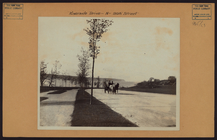
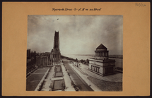
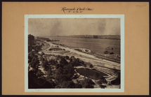
Manhattan: Riverside Drive - …
m
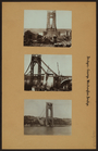
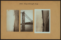
Bridges - George Washington B…
A topographical map of a part…
Van Der Donck's map of New Ne…
m
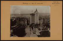
Manhattan: Broadway - Park Pl…
m
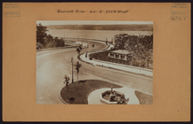
Manhattan: Riverside Drive - …
m
Manhattan: Riverside Drive - …
m
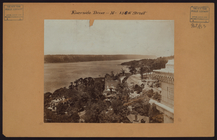
Manhattan: Riverside Drive - …
m
Manhattan: Riverside Drive - …
m
Manhattan: Riverside Drive - …
m
Manhattan: Riverside Drive - …
m
Manhattan: Riverside Drive - …
m
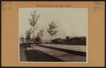
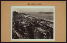
Manhattan: Riverside Park - 8…
m
Manhattan: Riverside Park - 8…
m
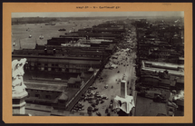
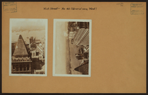
Manhattan: West Street - Cort…
m
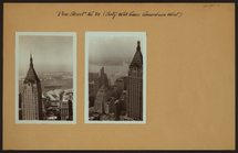
General view - [Manhattan - J…
m
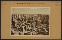
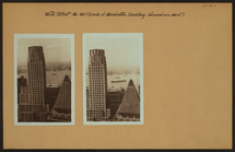
General view - [Midtown Manha…
m
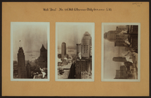
General view - [Manhattan - B…
m
General view - [Manhattan - B…
m
General view - [Manhattan - B…
m
General view - [Manhattan - B…
m
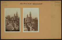
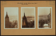
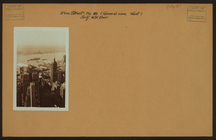
General view - Pine Street - …
m
General view - Pine Street.
m
General view - Pine Street - …
m
General view - Pine Street - …
m
General view - [Manhattan - W…
m
General view - [Manhattan - W…
m
General view - [Manhattan - W…
m
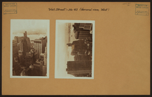
General view - Wall Street - …
m
Bridges - George Washington B…
m
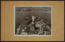
Islands - Bedloe's Island - S…
m
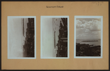
Islands - Governors Island - …
m
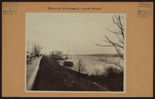
North (Hudson) River - River …
Bowles's new pocket map of th…
A chart of New York Harbour :…
A chart of Delaware Bay and R…
A chart of Delaware Bay and R…
Baye de la Delaware avec les …
A chart of the sea coast of N…