Click to visit the main New York Public Library Homepage
The New York Public Library
Digital Collections
About Digital Collections
Browse
Search only public domain materials
Items
Collections
Divisions
Home
Search
Browse
About
Search only public domain materials
Items
Collections
Divisions
Digital Collections
Using Images
Using Data
Search
Filtered search
Show filters
Hide filters
Show Only Public Domain
topic
Administrative and political divisions
2
Boundaries
1
Geography
1
Harbors
1
Indians of Mexico
1
More
Less
name
L'Isle, Guillaume de, 1675-1726
2
Stemmers, I
2
Barnard, W. S
1
Ch. Lubrecht & Co
1
Chatelain, Henri Abraham
1
More
Less
collection
Maps of North America
10
Lawrence H. Slaughter Collection of English maps, charts, globes, books and atlases
2
Mapa de la Sierra Gorda, y Costa del Seno Mexicano, desde la Ciudad de Queretero,circa 1763
1
place
x
North America
Mexico
13
United States
6
Central America
3
Caribbean Area
2
More
Less
genre
Maps
13
publisher
Chez Iean Covens & Corneille Mortier
2
Ch. Lubrecht & Co
1
E.F. Woodward
1
J.H. Colton
1
Johnson and Browning
1
More
Less
division
Map Division
12
Manuscripts and Archives Division
1
type
cartographic
13
Date Range
to
13 results found
Filtering on:
x
Place
: North America
x
Place
: Mexico
Sort by:
Title
Date created
Date digitized
Sequence
Topographical sketch of the s…
m
Colton's map of the United St…
Der amerikanische Continent: …
North America
m
Mitchell's new national map e…
m
Johnson's new illustrated & e…
Carte contenant le royaume du…
Map of the western and middle…
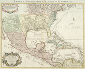
Carte du Mexique et de la Flo…
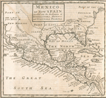
Mexico, or, New Spain : divid…
Messico, ouvero Nuova-Spagna …
Carte du Mexique et de la Flo…
Mapa de la Sierra Gorda, y Co…
End of results
|
Top