Click to visit the main New York Public Library Homepage
The New York Public Library
Digital Collections
About Digital Collections
Browse
Search only public domain materials
Items
Collections
Divisions
Home
Search
Browse
About
Search only public domain materials
Items
Collections
Divisions
Digital Collections
Using Images
Using Data
Search
Filtered search
Show filters
Hide filters
Show Only Public Domain
topic
x
Nautical charts
Trade routes
1
name
Mortier, Pierre
2
Bowles, Carington, 1724-1793
1
Cornel, Antonio
1
E. & G.W. Blunt (Firm)
1
Hooker, William, 1782-1856
1
More
Less
collection
Lawrence H. Slaughter Collection of English maps, charts, globes, books and atlases
4
Maps of the Oceans
3
place
x
North Atlantic Ocean
Atlantic Ocean
7
Maps
4
Early works to 1800
3
Atlantic Ocean -- Maps -- Early works to 1800
1
More
Less
genre
Maps
7
publisher
Chez Pierre Mortier libraire
1
Chez Pierre Mortier libraire,
1
Deposito Hidrografico
1
Printed for Robt. Sayer, map & printseller, No. 53 in Fleet Street,
1
Printed for the proprietor Carington Bowles
1
More
Less
division
Map Division
7
type
cartographic
7
Date Range
to
7 results found
Filtering on:
x
Place
: North Atlantic Ocean
x
Place
: Atlantic Ocean
x
Topic
: Nautical charts
Sort by:
Title
Date created
Date digitized
Sequence
Ocean Atlantique, ou, Mer du …
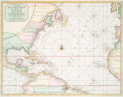
A chart of the Atlantic Ocean…
Ocean Atlantique, ou, Mer du …
Bowles's new pocket map of th…
Carta general del Oceano Atla…
m
A chart of the Atlantic or We…
Chart of the Atlantic Ocean :…