Click to visit the main New York Public Library Homepage
The New York Public Library
Digital Collections
About Digital Collections
Browse
Search only public domain materials
Items
Collections
Divisions
Home
Search
Browse
About
Search only public domain materials
Items
Collections
Divisions
Digital Collections
Using Images
Using Data
Search
Filtered search
Show filters
Hide filters
Show Only Public Domain
topic
Geological surveys
52
Canyons
22
Rock formations
5
Indians of North America
4
Inscriptions
3
More
Less
name
Geographical Surveys West of the 100th Meridian (U.S.)
50
Wheeler, George M. (George Montague), 1842-1905
50
O'Sullivan, Timothy H., 1840-1882
34
Bell, William, 1830-1910
17
Abert, John James, 1788-1863
2
More
Less
collection
Photographs showing landscapes, geological and other features of portions of the western territory of the United States, obtained in connection with geographical and geological explorations and surveys west of the 100th meridian, seasons of 1871, 1872 and 1873
49
Maps of North America
8
Report upon United States Geographical surveys west of the one hundredth meridian, in charge of First Lieut. Geo. M. Wheeler...U.S. Army. Atlas
2
Memoirs of my life
1
Photographs of geological formations and Western landscapes
1
place
x
United States
West (U.S.)
61
Colorado River (Colo.-Mexico)
27
Arizona
24
Grand Canyon (Ariz.)
10
More
Less
genre
Photographs
52
Maps
8
Illustrations
1
publisher
s.n
49
Govt. Print. Off
2
W.J. Keeler
2
publisher not identified
2
Belford, Clarke & Company
1
More
Less
division
Wallach Division: Photography Collection
52
Map Division
8
General Research Division
1
type
still image
53
cartographic
8
Date Range
to
61 results found
Filtering on:
x
Place
: United States
x
Place
: West (U.S.)
x
Rights
: Public Domain
Sort by:
Title
Date created
Date digitized
Sequence
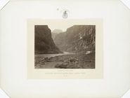
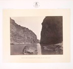
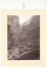
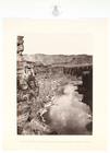
Colorado, mouth of Kanab Wash…
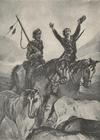
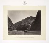
Carson and Godey returning fr…
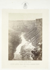
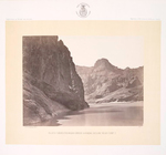
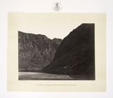
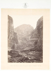
Grand Cañon, near the Paria, …
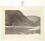
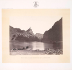
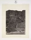
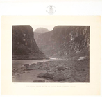
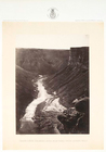
Grand Cañon, looking below mo…
Map of the Department of Dako…
m
National map of the territory…
Map of a reconnoissance betwe…
m
National map of the territory…
Map of the United States and …
Map illustrating the plan of …
Map of the territory of the U…
No. 15 map of Oregon and Uppe…
No. 5. Cooley's Park, Sierra …
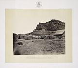
No. 6. Distant view of Camp A…
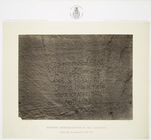
No. 8. Historic spanish recor…
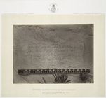
No. 9. Historic spanish recor…
No. 10. Ancient ruins in the …
No. 11. The Church of San Mig…
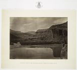
No. 12. Looking across the Co…
No. 13. Cañon of the Colorado…
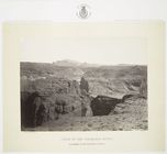
No. 14. South side of Inscrip…
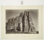
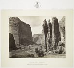
No. 15. Cañon de Chelle [Chel…
No. 16. Head of Cañon de Chel…
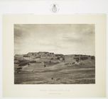
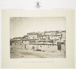
No. 17. Indian pueblo, Zuni, …
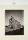
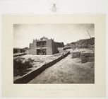
No. 18. Old Mission Church, Z…
No. 19. Section of south side…
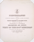
Titlepage
No. 1. Snow peaks, Bull Run m…
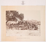
No. 2. Group of Pah-Ute [Paiu…
No. 3. Bluff opposite Big Hor…
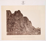
No. 4. Black Cañon, Colorado …
No. 5. Black Cañon, Colorado …
No. 6. Black Cañon, Colorado …
No. 7. Black Cañon, Colorado …
No. 8. Black Cañon, Colorado …
No. 9. Black Cañon, Colorado …
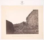
No. 10. Entrance to Black Cañ…
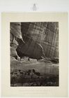
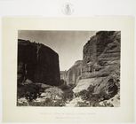
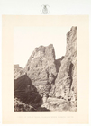
No. 11. Wall in the Grand Cañ…
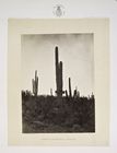
No. 12. Cereus giganteus, Ari…
No. 13. Water rhyolites, near…
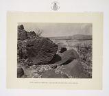
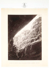
No. 14. Rock carved by drifti…
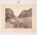
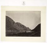
No. 15. Iceberg Cañon, Colora…
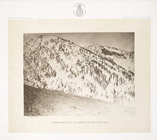
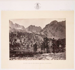
No. 16. Alpine lake, in the S…
No. 1. Cañon of Kanab Wash, C…
No. 2. Cañon of Kanab Wash, C…
No. 3. Cañon of Kanab Wash, C…
No. 4. Cañon of Kanab Wash, C…
No. 5. Colorado River, mouth …
No. 6. Grand Cañon, Colorado …
No. 7. Grand Cañon, Colorado …