Click to visit the main New York Public Library Homepage
The New York Public Library
Digital Collections
About Digital Collections
Browse
Search only public domain materials
Items
Collections
Divisions
Home
Search
Browse
About
Search only public domain materials
Items
Collections
Divisions
Digital Collections
Using Images
Using Data
Search
Filtered search
Show filters
Hide filters
Show Only Public Domain
topic
x
Administrative and political divisions
Landowners
2
Real property
2
Altitudes
1
Charts, diagrams, etc
1
More
Less
name
Holland, Samuel, 1728-1801
2
Balch, Vistus, 1799-1884
1
Bibliographischen Instituts (Hildburghausen, Germany)
1
Broenner, Harry Lodowick
1
Contger, Henry
1
More
Less
collection
Maps of New York City and State
5
Lawrence H. Slaughter Collection of English maps, charts, globes, books and atlases
3
place
x
New York (State)
New Jersey
3
New York
3
New York (N.Y.)
3
Québec (Province)
3
More
Less
genre
Maps
8
Aerial views
1
publisher
Ensign, Bridgman & Fanning
1
M. A. Lotter
1
M. Dripps
1
Potter Bros., Brokers
1
Printed for Robt. Sayer ... and T. Jefferys
1
More
Less
division
Map Division
8
type
cartographic
8
text
2
Date Range
to
8 results found
Filtering on:
x
Language term
: English
x
Place
: New York (State)
x
Topic
: Administrative and political divisions
Sort by:
Title
Date created
Date digitized
Sequence
Topographical map of New York…
The provinces of New York, an…
The provinces of New York, an…
A map of the provinces of New…
Plan von New-York, 1851
The tourist's map of the stat…
m
Map of the northern portion o…
m
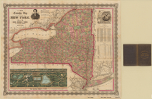
A new township map of the sta…